
IMAGES TAKEN NEAR TO
Moorcroft Road, YORK, YO24 2RG
Introduction
This page details the photographs taken nearby to Moorcroft Road, YO24 2RG by members of the Geograph project.
The Geograph project started in 2005 with the aim of publishing, organising and preserving representative images for every square kilometre of Great Britain, Ireland and the Isle of Man.

There are currently over 7.5m images from over14,400 individuals and you can help contribute to the project by visiting https://www.geograph.org.uk
Image Map
Images are licensed for reuse under creativecommons.org/licenses/by-sa/2.0
Notes
- Clicking on the map will re-center to the selected point.
- The higher the marker number, the further away the image location is from the centre of the postcode.
Image Listing (17 Images Found)
Images are licensed for reuse under creativecommons.org/licenses/by-sa/2.0
Image
Details
Distance
1

Moorcroft Road
Looking along Moorcroft Road in Woodthorpe on a Saturday Morning.
Image: © DS Pugh
Taken: 23 Oct 2021
0.01 miles
2

Moor Lane, Dringhouses (3)
Close to the junction of Moorcroft Road.
Image: © Richard Vince
Taken: 10 Apr 2015
0.06 miles
3

In Woodthorpe
Viewed looking along Grassholme.
Image: © Mary and Angus Hogg
Taken: 23 Sep 2025
0.07 miles
4
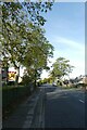
Moor Lane
Looking along Moor Lane on the southern edge of Woodthorpe.
Image: © DS Pugh
Taken: 23 Oct 2021
0.07 miles
5
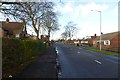
Along Moor Lane
Looking along Moor Lane in Woodthorpe.
Image: © DS Pugh
Taken: 2 Feb 2014
0.08 miles
6

Woodthorpe Garden Village
An attractive housing area in suburban York.
Image: © Mary and Angus Hogg
Taken: 23 Sep 2025
0.09 miles
7
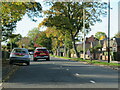
Moor Lane, Woodthorpe
Suburban road on the southwest side of York. The road marks the boundary of the built-up area in this part of the city, but there were recent plans to expand development further south [left of the road]. This would probably have caused damage to the nearby Askham Bog SSSI nature reserve, and it would appear that such development plans have been quashed.
Image: © Gordon Hatton
Taken: 28 Oct 2022
0.10 miles
8

Dick Turpin pub, Moorcroft Road
An estate pub built in 1965 by Cameron's brewery in the days when developers and planners were committed to providing community facilities. In the 2014 publication referred to below, it was included as 'one of the least altered of its kind'. However by 2025 CAMRA had removed it from their heritage list, presumably as the interior has now been modernised.
Image: © Stephen Craven
Taken: 10 May 2025
0.12 miles
9
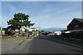
Shops in Woodthorpe
Looking along Moorcroft Road.
Image: © DS Pugh
Taken: 23 Oct 2021
0.14 miles
10

Shops in Woodthorpe
Ahead is the Dick Turpin pub and a parade of shops.
Image: © DS Pugh
Taken: 10 May 2025
0.14 miles