IMAGES TAKEN NEAR TO
Scarborough Road, MALTON, YO17 8EF
Introduction
This page details the photographs taken nearby to Scarborough Road, YO17 8EF by members of the Geograph project.
The Geograph project started in 2005 with the aim of publishing, organising and preserving representative images for every square kilometre of Great Britain, Ireland and the Isle of Man.

There are currently over 7.5m images from over14,400 individuals and you can help contribute to the project by visiting https://www.geograph.org.uk
Image Map
Images are licensed for reuse under creativecommons.org/licenses/by-sa/2.0
Notes
- Clicking on the map will re-center to the selected point.
- The higher the marker number, the further away the image location is from the centre of the postcode.
Image Listing (12 Images Found)
Images are licensed for reuse under creativecommons.org/licenses/by-sa/2.0
Image
Details
Distance
1
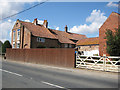
Villa Farm
Interesting building on Scarborough Road.
Image: © Pauline E
Taken: 26 Aug 2013
0.04 miles
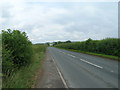
3
Scarborough Road junction with Westfield Way
Lights needed as Westfield Way leads to the industrial estate.
Image: © Pauline E
Taken: 1 Aug 2013
0.16 miles
5
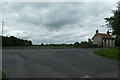
Traffic lights on Westfield Way
Junction with the B1248 Scarborough Road.
Image: © DS Pugh
Taken: 23 Jun 2020
0.18 miles
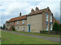
6
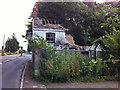
A doer upper
Or maybe a knock down and start all over again-er. Dilapidated house beside Scarborough Road.
Image: © Pauline E
Taken: 1 Aug 2013
0.20 miles
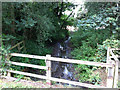
7
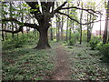
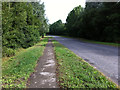
Path through the wood
Off Westfield Way, Norton on Derwent.
Image: © Jonathan Thacker
Taken: 22 Apr 2019
0.20 miles
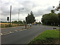
8
Westfield Way
Takes traffic from the industrial estate to Scarborough Road and the A64 - now accessible following the construction of a new junction at Brambling Fields.
Image: © Pauline E
Taken: 1 Aug 2013
0.22 miles
9
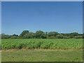
Crop east of Malton
Identification welcome. The trees in the background mark the course of the river Derwent.
Image: © Stephen Craven
Taken: 20 Aug 2020
0.22 miles