IMAGES TAKEN NEAR TO
Greame Road, BRIDLINGTON, YO16 6TQ
Introduction
This page details the photographs taken nearby to Greame Road, YO16 6TQ by members of the Geograph project.
The Geograph project started in 2005 with the aim of publishing, organising and preserving representative images for every square kilometre of Great Britain, Ireland and the Isle of Man.

There are currently over 7.5m images from over14,400 individuals and you can help contribute to the project by visiting https://www.geograph.org.uk
Image Map
Images are licensed for reuse under creativecommons.org/licenses/by-sa/2.0
Notes
- Clicking on the map will re-center to the selected point.
- The higher the marker number, the further away the image location is from the centre of the postcode.
Image Listing (449 Images Found)
Images are licensed for reuse under creativecommons.org/licenses/by-sa/2.0
Image
Details
Distance


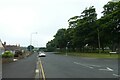
6

Rail line to Bridlington at Sewerby Gates
Bridlington Bay centre distance, from the level crossing
Image: © Martin Dawes
Taken: 15 Apr 2021
0.05 miles

10
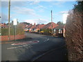
Limekiln Lane
Looking along Limekiln Lane near the junction with Sewerby Road.
Image: © DS Pugh
Taken: 12 Jul 2021
0.06 miles