IMAGES TAKEN NEAR TO
Watsons Lane, FILEY, YO14 9SD
Introduction
This page details the photographs taken nearby to Watsons Lane, YO14 9SD by members of the Geograph project.
The Geograph project started in 2005 with the aim of publishing, organising and preserving representative images for every square kilometre of Great Britain, Ireland and the Isle of Man.

There are currently over 7.5m images from over14,400 individuals and you can help contribute to the project by visiting https://www.geograph.org.uk
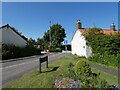
Image Map
Images are licensed for reuse under creativecommons.org/licenses/by-sa/2.0
Notes
- Clicking on the map will re-center to the selected point.
- The higher the marker number, the further away the image location is from the centre of the postcode.
Image Listing (77 Images Found)
Images are licensed for reuse under creativecommons.org/licenses/by-sa/2.0
Image
Details
Distance
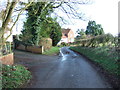
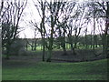
3
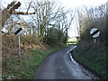
Heading east from Reighton
On Watson's Lane.
Image: © JThomas
Taken: 7 Feb 2016
0.04 miles
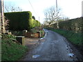
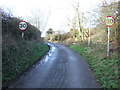
5
Disused field entrance off Watson's Lane, Reighton
Image: © JThomas
Taken: 7 Feb 2016
0.07 miles
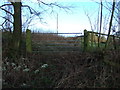
6
Watson's Lane, Reighton
A minor road to the east of Butts Hill.
Image: © Barbara Carr
Taken: 21 Jun 2013
0.08 miles
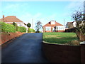
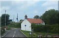
8
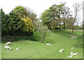
Reighton Manor
Pasture between Watson's Lane and the Manor House at the bottom of Church Lane, Reighton, on the northeast side of the old course of the A165 which has recently been diverted west of the village.
Image: © Paul Glazzard
Taken: 22 May 2008
0.09 miles