IMAGES TAKEN NEAR TO
Wykeham Carr Road, SCARBOROUGH, YO13 9QT
Introduction
This page details the photographs taken nearby to Wykeham Carr Road, YO13 9QT by members of the Geograph project.
The Geograph project started in 2005 with the aim of publishing, organising and preserving representative images for every square kilometre of Great Britain, Ireland and the Isle of Man.

There are currently over 7.5m images from over14,400 individuals and you can help contribute to the project by visiting https://www.geograph.org.uk
Image Map
Images are licensed for reuse under creativecommons.org/licenses/by-sa/2.0
Notes
- Clicking on the map will re-center to the selected point.
- The higher the marker number, the further away the image location is from the centre of the postcode.
Image Listing (11 Images Found)
Images are licensed for reuse under creativecommons.org/licenses/by-sa/2.0
Image
Details
Distance
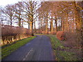
1
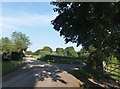
Minor road junction near Ruston Carr Cottages
Hudgin Lane bends southward towards Sherburn; the track east is known as Wykeham Carr Road, and leads into the Dawnay Estate.
Image: © Barbara Carr
Taken: 19 Jun 2013
0.02 miles
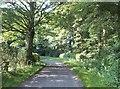
2
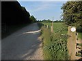
Wykeham Carr Lane
At the entry to the Dawnay Estate. 'NO ENTRY' - this was my second choice of road for heading east on my walk (see Image) so I had to rethink my plans and return to West Ayton via Brompton-by-Sawdon.
Image: © Barbara Carr
Taken: 19 Jun 2013
0.07 miles
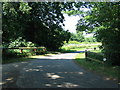
4
Roadside trees, Hudgin Lane
The road is beyond the trees.
Image: © Jonathan Thacker
Taken: 11 May 2017
0.10 miles
5
Country lane near Ruston Carr Plantation
Image: © Phil Catterall
Taken: 25 Jan 2007
0.13 miles
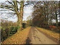
6
Leafy bend in Hudgin Lane
See Image for the view in January.
Image: © Barbara Carr
Taken: 19 Jun 2013
0.14 miles

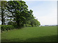
8
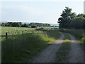
Track through farmland
A change of use from arable to grazing since 2009, see Image
Image: © Barbara Carr
Taken: 19 Jun 2013
0.18 miles

10
Culverted bridge carrying tributary of Ruston Beck
Image: © Phil Catterall
Taken: 4 Jul 2006
0.19 miles