
IMAGES TAKEN NEAR TO
North Marine Road, SCARBOROUGH, YO12 7EY
Introduction
This page details the photographs taken nearby to North Marine Road, YO12 7EY by members of the Geograph project.
The Geograph project started in 2005 with the aim of publishing, organising and preserving representative images for every square kilometre of Great Britain, Ireland and the Isle of Man.

There are currently over 7.5m images from over14,400 individuals and you can help contribute to the project by visiting https://www.geograph.org.uk
Image Map
Images are licensed for reuse under creativecommons.org/licenses/by-sa/2.0
Notes
- Clicking on the map will re-center to the selected point.
- The higher the marker number, the further away the image location is from the centre of the postcode.
Image Listing (380 Images Found)
Images are licensed for reuse under creativecommons.org/licenses/by-sa/2.0
Image
Details
Distance
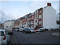
2

Queen's Terrace, Scarborough
A row of houses leads up to the Boston Hotel from the junction with Albert Street.
Image: © Andrew Smith
Taken: 26 Apr 2008
0.01 miles
3
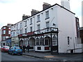
The Durham Hotel, Scarborough
On North Marine Road.
Image: © JThomas
Taken: 13 Feb 2016
0.02 miles
4
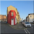
Scarborough: Queen's Terrace
A street between Queen's Parade (offstage left) and North Marine Road (offstage right), photographed on a bright August evening.
Image: © John Sutton
Taken: 19 Aug 2019
0.03 miles
5
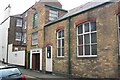
Gospel Hall
Durham Street Gospel Hall, Scarborough
Image: © Darren Haddock
Taken: 15 Jul 2005
0.04 miles
6
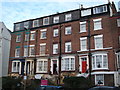
Townhouses on North Marine Road, Scarborough
Image: © JThomas
Taken: 13 Feb 2016
0.04 miles
7
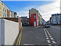
Wedge of buildings
Queens Parade and Queens Terrace. An area of mainly flats and small hotels. See also Image
Image: © Pauline E
Taken: 10 Feb 2014
0.04 miles
8

Red wedge
Interesting building tucked on the end between Queens Parade and Queens Terrace. See also Image
Image: © Pauline E
Taken: 10 Feb 2014
0.04 miles
9
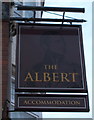
Sign for the Abert public house, Scarborough
Image: © JThomas
Taken: 13 Feb 2016
0.04 miles
10
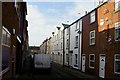
Clark Street
Looking down Clark Street which is a street of tightly built working class houses of about 1850-1860. The building on the right is The Free Dwellings built 1852 (but still 'Georgian' in style) and renovated in 1978. Lower Clark Street terminates at the bottom of the street with social housing built in 1986.
Image: © Christopher Hall
Taken: 10 Dec 2013
0.04 miles