
IMAGES TAKEN NEAR TO
Gladstone Street, SCARBOROUGH, YO12 7BN
Introduction
This page details the photographs taken nearby to Gladstone Street, YO12 7BN by members of the Geograph project.
The Geograph project started in 2005 with the aim of publishing, organising and preserving representative images for every square kilometre of Great Britain, Ireland and the Isle of Man.

There are currently over 7.5m images from over14,400 individuals and you can help contribute to the project by visiting https://www.geograph.org.uk
Image Map
Images are licensed for reuse under creativecommons.org/licenses/by-sa/2.0
Notes
- Clicking on the map will re-center to the selected point.
- The higher the marker number, the further away the image location is from the centre of the postcode.
Image Listing (134 Images Found)
Images are licensed for reuse under creativecommons.org/licenses/by-sa/2.0
Image
Details
Distance
1

Cleveland Road
Cleveland Road is actually a service lane which would probably have originally been occupied by stables and mews. Now these premises are occupied by small businesses such as car repair workshops.
Image: © Christopher Hall
Taken: 19 Dec 2014
0.03 miles
2
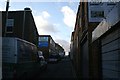
Gladstone Lane
Gladstone Lane is a service lane which would originally have been occupied by stables and mews. Now these buildings are occupied by small town centre businesses. seen here are a joinery workshop, MOT test centre and two car repair workshops.
Image: © Christopher Hall
Taken: 19 Dec 2014
0.03 miles

4
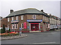
Beijing Chinese Restaurant - Northway
Image: © Betty Longbottom
Taken: 7 Sep 2010
0.04 miles
7
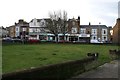
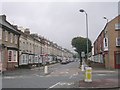
Gladstone road viewed from Northway
Northway was created in 1930 cutting through the 19th century street pattern leaving this triangular green space in front of Albion Terrace (to the left, not seen) and Gladstone Road. Gladstone Road has mixed uses, both residential and commercial. The building behind the white van is 3 Gladstone Road which was damaged by the German bombardment of Scarborough on December 16th 1914; it carries a plaque to this effect.
Image: © Christopher Hall
Taken: 10 Jan 2014
0.06 miles
8
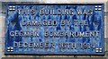
Detail of plaque on 3 Gladstone Road
Detail of the cast iron plaque on 3 Gladstone Road marking the fact that it was damaged during the German bombardment of Scarborough on 16 December 1914.
Image: © Christopher Hall
Taken: 10 Jan 2014
0.06 miles
10
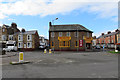
Benny's
Chinese and Thai food, Scarborough.
Image: © Pauline E
Taken: 19 Nov 2013
0.07 miles