
IMAGES TAKEN NEAR TO
Trafalgar Street West, SCARBOROUGH, YO12 7AX
Introduction
This page details the photographs taken nearby to Trafalgar Street West, YO12 7AX by members of the Geograph project.
The Geograph project started in 2005 with the aim of publishing, organising and preserving representative images for every square kilometre of Great Britain, Ireland and the Isle of Man.

There are currently over 7.5m images from over14,400 individuals and you can help contribute to the project by visiting https://www.geograph.org.uk
Image Map
Images are licensed for reuse under creativecommons.org/licenses/by-sa/2.0
Notes
- Clicking on the map will re-center to the selected point.
- The higher the marker number, the further away the image location is from the centre of the postcode.
Image Listing (292 Images Found)
Images are licensed for reuse under creativecommons.org/licenses/by-sa/2.0
Image
Details
Distance
1

Social Housing Trafalgar Street West/Melrose Street junction
At the junction of Trafalgar Street West and Melrose Street this social housing was built by the Scarborough Municipal Charity in 1982. The site was previously occupied by the Central Schools.
Image: © Christopher Hall
Taken: 10 Dec 2013
0.03 miles
2

Plaque on Genevieve Court, Trafalgar Street West
Details of a plaque marking the building of the social housing at the junction of Trafalgar Street West and Melrose Street. The 'Genevieve' referred to is Genevieve Lord M.B.E. a Fremman of the Borough of Scarborough and Trustee of the Scarborough Municipal Charity amongst other things.
Image: © Christopher Hall
Taken: 10 Dec 2013
0.03 miles
3
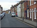
Victoria Street, Scarborough
Part of an area of streets of terraced houses to the west of the town centre.
Image: © Andrew Smith
Taken: 26 Apr 2008
0.05 miles
4
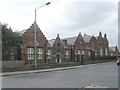
Former Workhouse - Dean Road
This is now run by the local NHS Trust.
Image: © Betty Longbottom
Taken: 7 Sep 2010
0.05 miles
5
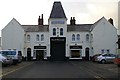
Duggleby's Auction Rooms, Vine St, Scarborough
This building has a remarkably complex history. It started life in the late 19th century as Foxton’s Mews. Behind this frontage there was a large courtyard surrounded by two storey buildings; some of the stables were at first floor level. W. Foxton & Son operated horse charbancs as well as carriages.
E H Robinson who took over altered it to house their motor charabancs – they traded as Scarborough & District, White Coach Tours & Royal Blue Coaches. Between January 1929 and April 1935 Vine Street depot was leased jointly by West Yorkshire Road Car Company & East Yorkshire Motor Services; buses went in at the back and came out through the large central door you can see. They did not renew the lease.The building them became car showrooms and finally auction rooms
Image: © Christopher Hall
Taken: 24 Nov 2013
0.05 miles
6
Scarborough Borough Council Employees Welfare Club - Dean Road
Image: © Betty Longbottom
Taken: 7 Sep 2010
0.05 miles
7
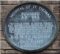
Plaque marking the hospital of St Thomas
The hospital of St Thomas was in North Street but this plaque marks replacement buildings in Hoxton Road
Image: © Christopher Hall
Taken: 23 Nov 2013
0.05 miles
8

Nelson Street from Trafalgar Street West
This part of Nelson Street developed in the 1860s and 1870s and it consists of terraces of working class houses built at the back edge of the footway, without forecourts. The building on the corner was a Wesleyan Mission Chapel dating from the 1870s; it is now used for a pre-school play group.
Image: © Christopher Hall
Taken: 10 Dec 2013
0.06 miles
9
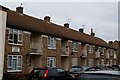
House in Hoxton Road
These houses were built in 1955 by the Scarborough Municipal Charity to replace houses built in 1862. The 1862 houses had been built to replace the medieval Hospital of St Thomas on North Street which had been demolished. There is a bronze plaque detailing these events
Image: © Christopher Hall
Taken: 23 Nov 2013
0.06 miles
10
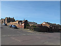
Junction of Dean Road and Trafalgar Road West, Scarborough
The building on the corner is the Council Welfare Club.
Image: © Stephen Craven
Taken: 26 Mar 2017
0.07 miles