Nelson Street from Trafalgar Street West
Introduction
The photograph on this page of Nelson Street from Trafalgar Street West by Christopher Hall as part of the Geograph project.
The Geograph project started in 2005 with the aim of publishing, organising and preserving representative images for every square kilometre of Great Britain, Ireland and the Isle of Man.

There are currently over 7.5m images from over 14,400 individuals and you can help contribute to the project by visiting https://www.geograph.org.uk
Nelson Street from Trafalgar Street West
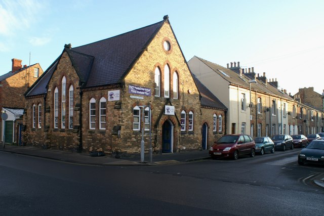
Image: © Christopher Hall Taken: 10 Dec 2013
This part of Nelson Street developed in the 1860s and 1870s and it consists of terraces of working class houses built at the back edge of the footway, without forecourts. The building on the corner was a Wesleyan Mission Chapel dating from the 1870s; it is now used for a pre-school play group.
Images are licensed for reuse under creativecommons.org/licenses/by-sa/2.0
Image Location
Latitude
54.283326
Longitude
-0.408024