
IMAGES TAKEN NEAR TO
Loftus Close, SCARBOROUGH, YO12 5TU
Introduction
This page details the photographs taken nearby to Loftus Close, YO12 5TU by members of the Geograph project.
The Geograph project started in 2005 with the aim of publishing, organising and preserving representative images for every square kilometre of Great Britain, Ireland and the Isle of Man.

There are currently over 7.5m images from over14,400 individuals and you can help contribute to the project by visiting https://www.geograph.org.uk
Image Map
Images are licensed for reuse under creativecommons.org/licenses/by-sa/2.0
Notes
- Clicking on the map will re-center to the selected point.
- The higher the marker number, the further away the image location is from the centre of the postcode.
Image Listing (15 Images Found)
Images are licensed for reuse under creativecommons.org/licenses/by-sa/2.0
Image
Details
Distance
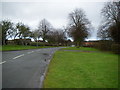
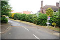
3
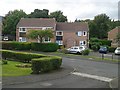
Installed Fascias Soffits At Flats 10-24 Settrington Road Scarborough
Installed fascias and soffits at flats 10-24 Settrington Road Scarborough YO12 5DL managed by Woodlands Vale Management Company Limited
Image: © Woodlands Vale
Taken: 21 Aug 2015
0.15 miles
4
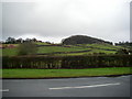
View towards Stepney Hill from Woodlands drive
Image: © Michael Jagger
Taken: 14 Feb 2010
0.16 miles
5
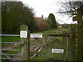
Public Footpath near Row Farm
For more details about Row Farm see:
http://www.rowfarmcottages.co.uk/
Image: © Michael Jagger
Taken: 14 Feb 2010
0.17 miles
6
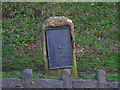
Scarborough Milestone
Beside the A170 on Stepney Hill. An 1854 map suggests the wording read "Scarborough 2" miles and "Malton 20" miles. Maps from 1919 and 1939 simply refer to an old milestone.
Image: © David Rogers
Taken: 6 Mar 2009
0.19 miles
7
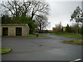
Bus Terminus on Woodlands drive
The drive to Row Farm can be seen in the distance, for more details see:
http://www.rowfarmcottages.co.uk/
Image: © Michael Jagger
Taken: 14 Feb 2010
0.19 miles
9
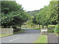
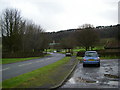
Entrance to Woodlands Crematorium
At the head of Woodlands Drive the Crematorium and adjoining cemetery, all owned by Scarborough Council.Surrounded by fields and backed by woodland there are sweeping views over the north side of Scarborough and the coast.
Image: © Martin Dawes
Taken: 18 Jul 2009
0.19 miles
10
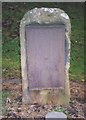
Old Milestone by the A170, Stepney Road, Scarborough
Milestone and iron plate by the A170, in parish of Scarborough (Scarborough District), Stepney Road, Scarborough, 80m South of Selly Park Drive, West side of road.
Inscription once read:-
(SCARBRO)
(2)
(MALTON)
(20)
Carved benchmark below plate.
Milestone Society National ID: YN_MASC20
Image: © Milestone Society
Taken: Unknown
0.20 miles