
IMAGES TAKEN NEAR TO
Falsgrave Road, SCARBOROUGH, YO12 5EY
Introduction
This page details the photographs taken nearby to Falsgrave Road, YO12 5EY by members of the Geograph project.
The Geograph project started in 2005 with the aim of publishing, organising and preserving representative images for every square kilometre of Great Britain, Ireland and the Isle of Man.

There are currently over 7.5m images from over14,400 individuals and you can help contribute to the project by visiting https://www.geograph.org.uk
Image Map
Images are licensed for reuse under creativecommons.org/licenses/by-sa/2.0
Notes
- Clicking on the map will re-center to the selected point.
- The higher the marker number, the further away the image location is from the centre of the postcode.
Image Listing (186 Images Found)
Images are licensed for reuse under creativecommons.org/licenses/by-sa/2.0
Image
Details
Distance
4
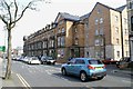
West Park Terrace, Falsgrave
This is a similar view to Image but taken recently. The former Falsgrave Service Station shown in the earlier photograph has gone and has been replaced by an extension to the terrace. The brick, stone and general appearance match in well, however the lower floor to ceiling heights in the modern part means there is an extra floor and the windows are more squat, less well proportioned. The detail of the new gable is visually weak.
Image: © Christopher Hall
Taken: 28 Apr 2014
0.02 miles
5
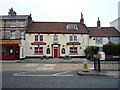
The New Tavern, Scarborough
On Falsgrave Road.
Image: © JThomas
Taken: 20 Feb 2016
0.03 miles
6

West Park Terrace, Falsgrave
West Park terrace on Falsgrave Road is unusual for Falsgrave in that it is monumental in scale. It is built in buff Scarborough brick with stone trim. It dates from about 1866 and the design is attributed to Dr T. T. Peiroou.
When this photograph was taken, the former Falsgrave Service station attached to the end of the terrace had security fencing around it prior to its demolition and redevelopment.
Image: © Christopher Hall
Taken: 25 Jul 2007
0.03 miles
7
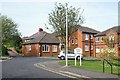
Sitwell Court from Acworth Street
Another view of Sitwell Court sheltered accommodation, which is also shown in Image This is the entrance to the site from Acworth Street.
Image: © Christopher Hall
Taken: 28 Apr 2014
0.03 miles
8
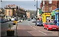
Falsgrave Road
This westerly facing photograph was taken from the pedestrian reservation on Falsgrave Road near its junction with Image on the right by the yellow fronted discount store.
At the traffic lights ahead Falsgrave Road continues toward its junction with Scalby Road and Stepney Road whilst the road off to the left is Seamer Road Corner.
The row of large terraced houses is West Park Terrace.
Behind and to the left of the viewpoint is the junction of Image with New Park Road.
For another photograph of Falsgrave Road taken some 35metres behind the viewpoint, click here Image
Road name information from OS Maps.
** ** **
In the news: http://www.scarborougheveningnews.co.uk/news/Robbery-terror-for-Falsgrave-offlicence.4389517.jp
Image: © Alan Walker
Taken: 9 Apr 2008
0.04 miles
9

Porches, Falsgrave Road
These terrace houses on the north side of Falsgrave Road date from the mid 19th century and have nicely detailed porches. The buff brick houses to the left are earlier and the porches still have a Regency feel about them, whereas the later ones to the right are Victorian in detail.
Image: © Christopher Hall
Taken: 30 Jun 2008
0.04 miles
10
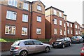
Sitwell Court, Sitwell Street
Sitwell Court is a development of sheltered flats on the site of the girls and infants part of the former Falsgrave Board School; the former boys part on the opposite side of the street is still extant as a building and is shown in Image
Image: © Christopher Hall
Taken: 28 Apr 2014
0.04 miles