
IMAGES TAKEN NEAR TO
Westwood Road, SCARBOROUGH, YO11 2JH
Introduction
This page details the photographs taken nearby to Westwood Road, YO11 2JH by members of the Geograph project.
The Geograph project started in 2005 with the aim of publishing, organising and preserving representative images for every square kilometre of Great Britain, Ireland and the Isle of Man.

There are currently over 7.5m images from over14,400 individuals and you can help contribute to the project by visiting https://www.geograph.org.uk
Image Map
Images are licensed for reuse under creativecommons.org/licenses/by-sa/2.0
Notes
- Clicking on the map will re-center to the selected point.
- The higher the marker number, the further away the image location is from the centre of the postcode.
Image Listing (303 Images Found)
Images are licensed for reuse under creativecommons.org/licenses/by-sa/2.0
Image
Details
Distance
1
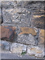
Bench mark between #12 and #14 Westwood Road
This bench mark is on the old stone wall in Westwood Road. It is first recorded on the Town plan of 1892 on the garden wall of Stamford House. See also Image
Image: © John S Turner
Taken: 27 Jan 2011
0.01 miles
2
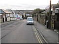
Westwood Road, Scarborough
Looking south west along Westwood Road. There is a bench mark on the old stone wall on the right, between #12 and #14. Image
Image: © John S Turner
Taken: 27 Jan 2011
0.01 miles
3
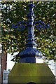
Gate post detail, Westwood
The gate post of one of the villas shown inImage is topped by the cast iron column which probably carried a lamp.
Image: © Christopher Hall
Taken: 20 Jan 2014
0.03 miles
4
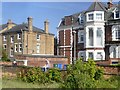
Watching the trains go by
Viewed from the passing steam-hauled Coast to Coast Express.
Image: © Graham Hogg
Taken: 19 May 2018
0.03 miles

6
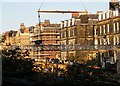
Dismantling Falsgrave signal gantry 2
This view is from Westover Road shows the dismantling of the Falsgrave signal gantry on 19 October 2010. The large buildings in the background are on Westwood and are also seen in Image
Image: © Christopher Hall
Taken: 7 Oct 2010
0.05 miles
7
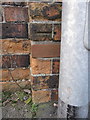
Damaged bench mark in Westwood
Only half of this bench mark is left as a brick has been replaced in the wall buttress. The mark is in Westwood directly opposite the end of Westwood Road, and is first recorded on the 1892 Town Plan. The railway line into Scarborough station is on the other side of the wall. See also Image
Image: © John S Turner
Taken: 27 Jan 2011
0.05 miles
8
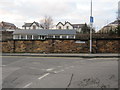
Westwood from Westwood Road
Looking across the junction of Westwood and Westwood Road. There is a damaged bench mark on the brick buttress just to the left of the lamppost Image The railway line into Scarborough station is on the other side of the wall, and the roof of the Grade II listed Falsgrave signal box can be seen above the wall.
Image: © John S Turner
Taken: 27 Jan 2011
0.05 miles
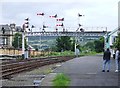
10
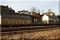
Falsgrave signal box from Westwood
The building on the right is Falsgrave signal box built by the NER in about 1907. Until 2010 it controlled the station approaches to Scarborough - it was named Falsgrave to distinguish it from another box closer to the Station. At its peak it had a 120-lever frame. In its later years, Falsgrave box controlled a mixture of colour-light and semaphore signals but since 2010 new colour light signalling was installed controlled from Seamer and Falsgrave signal box is now out of use. The buff brick building on the left contains some of the modern control equipment. There was a gantry carrying semaphores signals in front of Falsgrave box but this was dismantled and removed to the North York Moors Railway in October 2010. Photographs Image and Image show the dismantling.
Behind and between the two building is the portal to the former tunnel serving the Scarborough to Whitby line.
Image: © Christopher Hall
Taken: 20 Jan 2014
0.05 miles