Falsgrave signal box from Westwood
Introduction
The photograph on this page of Falsgrave signal box from Westwood by Christopher Hall as part of the Geograph project.
The Geograph project started in 2005 with the aim of publishing, organising and preserving representative images for every square kilometre of Great Britain, Ireland and the Isle of Man.

There are currently over 7.5m images from over 14,400 individuals and you can help contribute to the project by visiting https://www.geograph.org.uk
Falsgrave signal box from Westwood
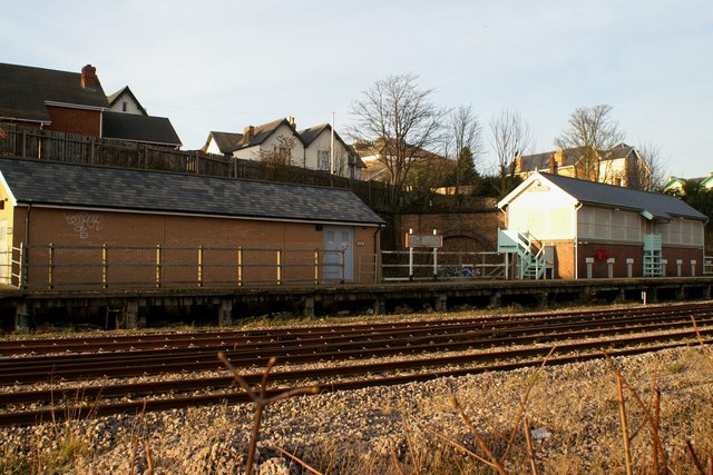
Image: © Christopher Hall Taken: 20 Jan 2014
The building on the right is Falsgrave signal box built by the NER in about 1907. Until 2010 it controlled the station approaches to Scarborough - it was named Falsgrave to distinguish it from another box closer to the Station. At its peak it had a 120-lever frame. In its later years, Falsgrave box controlled a mixture of colour-light and semaphore signals but since 2010 new colour light signalling was installed controlled from Seamer and Falsgrave signal box is now out of use. The buff brick building on the left contains some of the modern control equipment. There was a gantry carrying semaphores signals in front of Falsgrave box but this was dismantled and removed to the North York Moors Railway in October 2010. Photographs Image and Image show the dismantling. Behind and between the two building is the portal to the former tunnel serving the Scarborough to Whitby line.
Images are licensed for reuse under creativecommons.org/licenses/by-sa/2.0
Image Location


Leaflet Map data © OpenStreetMap
Latitude
54.276423
Longitude
-0.409366