
IMAGES TAKEN NEAR TO
Lastingham Terrace, YORK, YO10 4BW
Introduction
This page details the photographs taken nearby to Lastingham Terrace, YO10 4BW by members of the Geograph project.
The Geograph project started in 2005 with the aim of publishing, organising and preserving representative images for every square kilometre of Great Britain, Ireland and the Isle of Man.

There are currently over 7.5m images from over14,400 individuals and you can help contribute to the project by visiting https://www.geograph.org.uk
Image Map
Images are licensed for reuse under creativecommons.org/licenses/by-sa/2.0
Notes
- Clicking on the map will re-center to the selected point.
- The higher the marker number, the further away the image location is from the centre of the postcode.
Image Listing (351 Images Found)
Images are licensed for reuse under creativecommons.org/licenses/by-sa/2.0
Image
Details
Distance
1

Lastingham Terrace
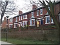
Turn of the 19th/20th Centuries terrace in three sections, overlooking New Walk alongside the River Ouse and running across the end of Hartoft Street and Farndale Street. It was first marked on the 1909 25 inch map.
Image: © Ian Capper
Taken: 4 Feb 2023
0.00 miles
2

Former well on the banks of the River Ouse
Image: © Gareth James
Taken: 11 Jun 2012
0.01 miles
3
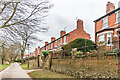
Lastingham Terrace
Turn of the 19th/20th Centuries terrace in three sections, overlooking New Walk alongside the River Ouse and running across the end of Hartoft Street and Farndale Street. It was first marked on the 1909 25 inch map.
Image: © Ian Capper
Taken: 4 Feb 2023
0.01 miles
4
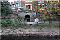
Pikeing Well, York
York's attempt to become a mineral spa with a well head built over a spring. This particular building is an 1858 rebuild of an earlier structure.
Image: © Chris Allen
Taken: 30 Oct 2017
0.01 miles
6
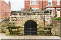
Pikeing Well
Well house on New Walk built in 1752, designed by John Carr, in an attempt by the City to develop a spa. Grade II* listed - see https://historicengland.org.uk/listing/the-list/list-entry/1257053?section=official-list-entry. For a photo of the nearby commemorative plaque see Image
Image: © Ian Capper
Taken: 4 Feb 2023
0.01 miles
7
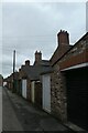
Garages near Hartoft Street
Looking along a row of garages between Hartoft Street and Farndale Street.
Image: © DS Pugh
Taken: 29 Aug 2020
0.01 miles
8
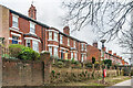
Lastingham Terrace
Turn of the 19th/20th Centuries terrace in three sections, overlooking New Walk alongside the River Ouse and running across the end of Hartoft Street and Farndale Street. It was first marked on the 1909 25 inch map.
Image: © Ian Capper
Taken: 4 Feb 2023
0.02 miles
9
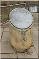
Plaque, Pikeing Well
Plaque next to the Pikeing Well on New Walk (see Image). It reads:
PIKEING WELL
Several wells existed along this stretch of the river. In 1740 New Walk was extended from Blue Bridge past Pikeing Well. In 1749 the corporation of York agreed to “contract with proper workmen for the making of a hansom (sic) fountain at Pikeing Well”. A well house was built in 1752 to the designs of John Carr who later became Yorkshire's most notable Georgian Architect. In 1858 a re-building of this well house was carried out by Thomas Pickersgill the City Surveyor. The structure is now listed grade II*. Water from the well was thought to have medicinal qualities, particularly in the treatment of sore eyes. The Pikeing Well was restored in the year 2000 as part of the Millennium Bridge Project.
Image: © Ian Capper
Taken: 4 Feb 2023
0.02 miles
10
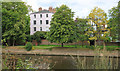
Houses by New Walk, York
The River Ouse is in the foreground.
Image: © Michael Fox
Taken: 7 Jul 2011
0.02 miles