1
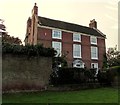
Manor Cottage, High Street, Albrighton
On the west side of housing and lockup garages in Wolverley Court. http://www.geograph.org.uk/photo/4756335
Image: © Jaggery
Taken: 1 Dec 2015
0.06 miles
2
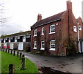
Wolverley Court, Albrighton
Housing with lock-up garages viewed from High Street.
Image: © Jaggery
Taken: 1 Dec 2015
0.06 miles
3
3-storey house on an Albrighton corner
High Street side of the house on the corner of Cross Road.
Image: © Jaggery
Taken: 1 Dec 2015
0.06 miles
4
Kill Your Speed, Albrighton
On a lamppost on the corner of High Street and Cross Road (ahead).
Image: © Jaggery
Taken: 1 Dec 2015
0.07 miles
5
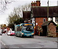
Wolverhampton bus in Albrighton
The Arriva single-decker on route 8 to Wolverhampton is at a High Street bus stop.
Image: © Jaggery
Taken: 1 Dec 2015
0.07 miles
6
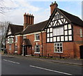
The Crown, Albrighton
High Street side of a pub extending around the corner ahead into Station Road.
Built as a house in the 16th century, remodelled in the early 18th century
with various later additions and alterations. Grade II listed in 1984.
Image: © Jaggery
Taken: 1 Dec 2015
0.07 miles
7
Stone bus shelter, Albrighton
On the north side of High Street.
Image: © Jaggery
Taken: 1 Dec 2015
0.07 miles
8
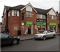
Co-operative Food store and Aroma restaurant, High Street, Albrighton
Co-op on the ground floor, entrance ahead. Aroma Indian restaurant and takeaway on the first floor,
entrance http://www.geograph.org.uk/photo/4758674 on the left side of the building.
Image: © Jaggery
Taken: 1 Dec 2015
0.07 miles
9
Corner view of The Crown, Albrighton
On the corner of High Street (on the right) and Station Road.
Built as a house in the 16th century, remodelled in the early 18th century
with various later additions and alterations. Grade II listed in 1984.
Image: © Jaggery
Taken: 1 Dec 2015
0.08 miles
10
Indulgence in Albrighton
High Street hairdressers.
Image: © Jaggery
Taken: 1 Dec 2015
0.08 miles


