
IMAGES TAKEN NEAR TO
St. Cuthberts Crescent, WOLVERHAMPTON, WV7 3HP
Introduction
This page details the photographs taken nearby to St. Cuthberts Crescent, WV7 3HP by members of the Geograph project.
The Geograph project started in 2005 with the aim of publishing, organising and preserving representative images for every square kilometre of Great Britain, Ireland and the Isle of Man.

There are currently over 7.5m images from over14,400 individuals and you can help contribute to the project by visiting https://www.geograph.org.uk
Image Map
Images are licensed for reuse under creativecommons.org/licenses/by-sa/2.0
Notes
- Clicking on the map will re-center to the selected point.
- The higher the marker number, the further away the image location is from the centre of the postcode.
Image Listing (46 Images Found)
Images are licensed for reuse under creativecommons.org/licenses/by-sa/2.0
Image
Details
Distance
1
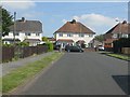
St Cuthbert's Crescent meets Bowling Green Lane
Image: © Peter Whatley
Taken: 8 Jun 2013
0.09 miles
2
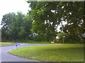
Bowling Green Lane Island
The view in Albrighton.
Image: © Gordon Griffiths
Taken: 20 Jun 2018
0.11 miles
3
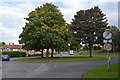
Roundabout at the top of Bowling Green Lane
Fntering the urban area.
Image: © John M
Taken: 8 Oct 2013
0.11 miles
4

Grange Park, Albrighton
Newport Road end of a long cul-de-sac named Grange Park.
Image: © Jaggery
Taken: 1 Dec 2015
0.14 miles
5
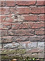
OS benchmark - Albrighton, Bowling Green Lane
The rather badly damaged remains of an OS cutmark in the brickwork of a building on the north side of Bowling Green Lane; originally levelled in 1959 at 93.632m above Ordnance Datum Newlyn.
Image: © Richard Law
Taken: 11 May 2014
0.15 miles
6
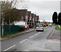
Worthington Drive houses, Albrighton
These houses on the south side of Worthington Drive are opposite a football pitch http://www.geograph.org.uk/photo/4757941 near the perimeter of the RAF Cosford site.
Image: © Jaggery
Taken: 1 Dec 2015
0.15 miles
7

VE Day Anniversary bench, Donington
Located alongside Newport Road near a Welcome to Albrighton sign. http://www.geograph.org.uk/photo/4757516
The inscription on the small metal plate on the bench is
IN COMMEMORATION AND REMEMBRANCE
50TH ANNIVERSARY V.E. DAY 1945-1995
DONATED BY THE PEOPLE OF DONINGTON PARISH.
V.E. (Victory in Europe) Day was the public holiday on May 8th 1945 to mark the formal acceptance by the Allies of Nazi Germany's unconditional surrender of its armed forces, marking the end of the Second World War in Europe.
Image: © Jaggery
Taken: 1 Dec 2015
0.16 miles
8
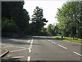
Newport Road at the entrance to Grange Park
Image: © Peter Whatley
Taken: 8 Jun 2013
0.16 miles
9

Welcome to Albrighton
The sign faces Newport Road opposite the Grange Park junction. http://www.geograph.org.uk/photo/4757515
Albrighton is a large village in the east of Shropshire, northwest of Wolverhampton.
The colourful Welcome sign is identical with one http://www.geograph.org.uk/photo/4755325 on the Station Road side of the village.
There is a yellow sign depicting a CCTV camera above this sign but not above the Station Road sign.
Image: © Jaggery
Taken: 1 Dec 2015
0.16 miles
10
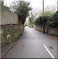
Bowling Green Lane, Albrighton
Viewed from the corner of Newport Road.
Image: © Jaggery
Taken: 1 Dec 2015
0.17 miles