IMAGES TAKEN NEAR TO
Wergs Road, WOLVERHAMPTON, WV6 9BN
Introduction
This page details the photographs taken nearby to Wergs Road, WV6 9BN by members of the Geograph project.
The Geograph project started in 2005 with the aim of publishing, organising and preserving representative images for every square kilometre of Great Britain, Ireland and the Isle of Man.

There are currently over 7.5m images from over14,400 individuals and you can help contribute to the project by visiting https://www.geograph.org.uk
Image Map
Images are licensed for reuse under creativecommons.org/licenses/by-sa/2.0
Notes
- Clicking on the map will re-center to the selected point.
- The higher the marker number, the further away the image location is from the centre of the postcode.
Image Listing (11 Images Found)
Images are licensed for reuse under creativecommons.org/licenses/by-sa/2.0
Image
Details
Distance
1
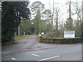
Government Offices - Woodthorne
This is one of the more anonymous governmental offices. The HQ of ADAS, Agric Advisory Service is hidden somewhere behind the trees. These offices have had numerous names and titles over the years Ministry of Agriculture, Fisheries and Food (MAFF) and now DEFRA.
Image: © John M
Taken: 30 Dec 2006
0.13 miles
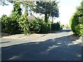
2
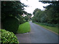
The start of the Tettenhall to Palmer's Cross bridleway
Coppice Lane, at this end a metalled track giving access to a handful of houses, turns into a proper singletrack bridleway a little further on.
Image: © Richard Law
Taken: 25 Sep 2009
0.13 miles
3
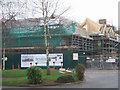
New Care Home on the Wergs Road
A major new residential and care home for Sunrise Senior Living is taking shape, adjacent to the Wrottesley Park Nursing Home.
Image: © John M
Taken: 30 Dec 2006
0.14 miles
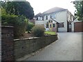
4
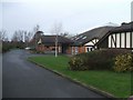
Wrottesley Park Nursing Home
The nursing home has a long frontage on the Wergs Road. A new development adjacent will offer housing for senior citizens.
Image: © John M
Taken: 30 Dec 2006
0.15 miles
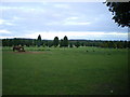
6
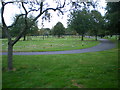
Danescourt Cemetery, Tettenhall
The 1:50,000 map appears to mark the cemetery in the next square east, which to be truthful is where most of it does really lie. But it also stretches into SJ8700, so this seems a valid photo.
Image: © Richard Law
Taken: 25 Sep 2009
0.17 miles
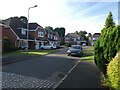
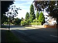
10
Junction of Woodthorne Road and Cranmere Avenue
Image: © ElfExplorer
Taken: 21 Aug 2024
0.25 miles