IMAGES TAKEN NEAR TO
School Road, WOLVERHAMPTON, WV6 8ET
Introduction
This page details the photographs taken nearby to School Road, WV6 8ET by members of the Geograph project.
The Geograph project started in 2005 with the aim of publishing, organising and preserving representative images for every square kilometre of Great Britain, Ireland and the Isle of Man.

There are currently over 7.5m images from over14,400 individuals and you can help contribute to the project by visiting https://www.geograph.org.uk
Image Map
Images are licensed for reuse under creativecommons.org/licenses/by-sa/2.0
Notes
- Clicking on the map will re-center to the selected point.
- The higher the marker number, the further away the image location is from the centre of the postcode.
Image Listing (108 Images Found)
Images are licensed for reuse under creativecommons.org/licenses/by-sa/2.0
Image
Details
Distance
1
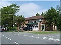
Bird in Hand
A Public House on School Road Tettenhall Wood.
Image: © Gordon Griffiths
Taken: 6 Jun 2007
0.01 miles
3
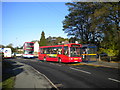
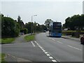
Buses on School Road, Tettenhall Wood
A 10, which has just arrived from Perton via the bus only link road, picks up passengers on School Road in Tettenhall Wood on its way to Wolverhampton town centre. This is the direct route from here to town, via Compton; the double decker behind it is on route 1, which provides a more frequent but longer route into town via Tettenhall, and for some reason continues across Wolverhampton to Dudley via Sedgley. The 1 begins here: the double decker has just used the junction with Mill Lane, at which the van is waiting, to turn round. Mill Lane forms the boundary, physically and administratively, of the City of Wolverhampton. To the right of the bus shelter is the sign for the Bird in Hand pub, which is out of frame to the right.
Image: © Richard Vince
Taken: 6 Oct 2011
0.02 miles

7
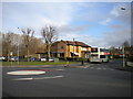
North west end of School Road, Tettenhall Wood
Seen from Mill Lane, on the western edge, physically and administratively, of the City of Wolverhampton. The bus in School Road has just turned in this junction, which is something of a tight squeeze for a modern double decker. It is waiting outside the former Bird in Hand pub, which has been converted into a cafe and beauty parlour.
Image: © Richard Vince
Taken: 10 Jan 2014
0.03 miles
8
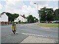
Yew Tree Lane Island View
The view from School Road Tettenhall Wood.
Image: © Gordon Griffiths
Taken: 22 Jul 2021
0.04 miles