IMAGES TAKEN NEAR TO
Cheriton Grove, WOLVERHAMPTON, WV6 7SP
Introduction
This page details the photographs taken nearby to Cheriton Grove, WV6 7SP by members of the Geograph project.
The Geograph project started in 2005 with the aim of publishing, organising and preserving representative images for every square kilometre of Great Britain, Ireland and the Isle of Man.

There are currently over 7.5m images from over14,400 individuals and you can help contribute to the project by visiting https://www.geograph.org.uk
Image Map
Images are licensed for reuse under creativecommons.org/licenses/by-sa/2.0
Notes
- Clicking on the map will re-center to the selected point.
- The higher the marker number, the further away the image location is from the centre of the postcode.
Image Listing (120 Images Found)
Images are licensed for reuse under creativecommons.org/licenses/by-sa/2.0
Image
Details
Distance
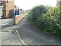
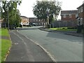
7
Path between Itchen Grove and Hamble Grove
Image: © ElfExplorer
Taken: 6 Sep 2023
0.08 miles
9
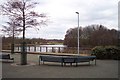
Lake in the Centre of Perton
Perton is a large housing estate built on the site of a former airfield
Image: © Geoff Pick
Taken: 25 Feb 2006
0.10 miles