
IMAGES TAKEN NEAR TO
Bridgnorth Avenue, WOLVERHAMPTON, WV5 0AD
Introduction
This page details the photographs taken nearby to Bridgnorth Avenue, WV5 0AD by members of the Geograph project.
The Geograph project started in 2005 with the aim of publishing, organising and preserving representative images for every square kilometre of Great Britain, Ireland and the Isle of Man.

There are currently over 7.5m images from over14,400 individuals and you can help contribute to the project by visiting https://www.geograph.org.uk
Image Map
Images are licensed for reuse under creativecommons.org/licenses/by-sa/2.0
Notes
- Clicking on the map will re-center to the selected point.
- The higher the marker number, the further away the image location is from the centre of the postcode.
Image Listing (56 Images Found)
Images are licensed for reuse under creativecommons.org/licenses/by-sa/2.0
Image
Details
Distance
1
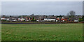
Staffordshire farmland south-west of Wombourne
Looking north-north-west from Botterham Lane. The housing is by the B4176 Bridgnorth Road. The field near the road contained potatoes last year.
Image: © Roger Kidd
Taken: 1 Jan 2022
0.09 miles
2
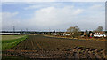
Staffordshire farmland south-west of Wombourne
Looking north-west from Botterham Lane. The housing is by the B4176 Bridgnorth Road.
The sun has finally managed to break through (for a short time) after a cloudy but bright New Year's Day morning. It's around 13°C, Wind Force 2-3 WSW. In other parts of the country record high temperatures for New Year's Day were recorded, up to 16·3°C
Gordon snapped it with last year's spuds growing nicely :-) Image]
Image: © Roger Kidd
Taken: 1 Jan 2022
0.09 miles
3
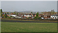
Farmland and housing near Wombourne in Staffordshire
Looking north-west from Botterham Lane. The housing is by the B4176 Bridgnorth Road.
Image: © Roger Kidd
Taken: 1 Jan 2022
0.10 miles
4
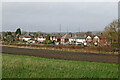
Farmland and housing near Wombourne in Staffordshire
Looking north-west from Botterham Lane. The housing is by the B4176 Bridgnorth Road.
Image: © Roger Kidd
Taken: 1 Jan 2022
0.11 miles
5
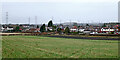
Staffordshire farmland south-west of Wombourne
Looking north-north-west from Botterham Lane. The housing is by the B4176 Bridgnorth Road. The field near the road contained potatoes last year.
Image: © Roger Kidd
Taken: 1 Jan 2022
0.11 miles
6
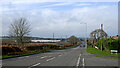
Bridgnorth Road near Wombourne in Staffordshire
Looking north-west towards Telford near the junctions with Banbery Drive and Botterham Lane.
Image: © Roger Kidd
Taken: 1 Jan 2022
0.12 miles
7
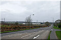
Bridgnorth Road near Wombourne in Staffordshire
Looking west-north-west across the B4174 Bridgnorth Road from near the junction with Common Road. Banbery Drive leads off to the left. Botterham Lane leads off to the left. The big white building on the Wombourne Enterprise Park is the warehouse of Spectrum Brands (domestic electrical appliances).
Image: © Roger Kidd
Taken: 1 Jan 2022
0.13 miles
8
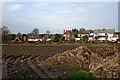
Farmland, housing and heap near Wombourne
Looking north-north-west. The housing is by the B4176 Bridgnorth Road. The heap is by Botterham Lane. Potatoes were grown here in 2021.
Image: © Roger Kidd
Taken: 1 Jan 2022
0.13 miles
9
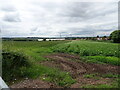
Botterham Lane view
The view near Swindon, Staffordshire.
Image: © Gordon Griffiths
Taken: 12 Jul 2021
0.14 miles
10
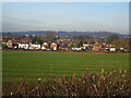
Field view
The view from Botterham Lane towards the Bridgnorth Road in Wombourne.
Image: © Gordon Griffiths
Taken: 23 Jan 2023
0.15 miles