IMAGES TAKEN NEAR TO
Sharon Close, WOLVERHAMPTON, WV4 6EU
Introduction
This page details the photographs taken nearby to Sharon Close, WV4 6EU by members of the Geograph project.
The Geograph project started in 2005 with the aim of publishing, organising and preserving representative images for every square kilometre of Great Britain, Ireland and the Isle of Man.

There are currently over 7.5m images from over14,400 individuals and you can help contribute to the project by visiting https://www.geograph.org.uk
Image Map
Images are licensed for reuse under creativecommons.org/licenses/by-sa/2.0
Notes
- Clicking on the map will re-center to the selected point.
- The higher the marker number, the further away the image location is from the centre of the postcode.
Image Listing (110 Images Found)
Images are licensed for reuse under creativecommons.org/licenses/by-sa/2.0
Image
Details
Distance
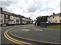
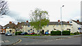
1
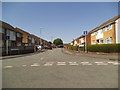
Sharon Close
The view in Parkfield, Wolverhampton.
Image: © Gordon Griffiths
Taken: 1 Aug 2013
0.01 miles
2
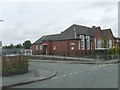
Parkfield Primary School
The School in Bowen Street.
Image: © Gordon Griffiths
Taken: 20 Aug 2008
0.04 miles
3
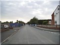
Dimmock Street
The view in Parkfield, Wolverhampton.
Image: © Gordon Griffiths
Taken: 23 Jul 2013
0.05 miles
4
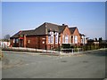
Parkfield Primary School
On the crossroads of Bowen Street and Dimmock Street.
Image: © Richard Law
Taken: 20 Mar 2009
0.05 miles
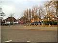
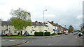
5
Parkfield Crescent View
The view down Parkfield Road in Wolverhampton.
Image: © Gordon Griffiths
Taken: 30 Jul 2013
0.05 miles
6
Parkfield Road Close
The view off the A4039 in Parkfield, Wolverhampton.
Image: © Gordon Griffiths
Taken: 18 Mar 2013
0.06 miles
7
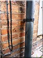
OS benchmark - 187 Parkfield Road
Not the greatest photo in the world, but the observant will pick out the benchmark cut into the course of bricks immediately below the downpipe bracket. This was originally levelled at 152.266m above Ordnance Datum Newlyn.
Image: © Richard Law
Taken: 13 Aug 2013
0.06 miles
8
Bowen Street
The view in Parkfield, Wolverhampton.
Image: © Gordon Griffiths
Taken: 1 Aug 2013
0.07 miles
9
Housing in Parkfield Crescent, Wolverhampton
This interestingly shaped terrace is on the corner of Parkfield Terrace and Parkfield Road just over a mile south-east of Wolverhampton City Centre.
Image: © Roger Kidd
Taken: 20 Apr 2012
0.07 miles
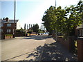
10
Parkfield Road in Wolverhampton
Parkfield Crescent leads off to the left. Bowen Street is off to the right. Parkfield Road is the A4039 between Penn and Bilston.
Image: © Roger Kidd
Taken: 20 Apr 2012
0.07 miles