1
Hartill Road
The view in Penn, Wolverhampton.
Image: © Gordon Griffiths
Taken: 1 Dec 2014
0.04 miles
2
Buttons Farm Road
The view in Penn, Wolverhampton.
Image: © Gordon Griffiths
Taken: 30 Mar 2013
0.08 miles
3
Field Scene
The view from the footpath off Chamberlain's Lane in Lower Penn.
Image: © Gordon Griffiths
Taken: 10 Jul 2023
0.09 miles
4
Buttons Farm Road End
The view from Hartill Road junction in Penn, Wolverhampton.
Image: © Gordon Griffiths
Taken: 1 Dec 2014
0.09 miles
5
Holden Road
The view from Buttons Farm Road, Penn.
Image: © Gordon Griffiths
Taken: 22 Dec 2020
0.11 miles
6
Holden Road, Spring Hill, Wolverhampton
Semi-detached housing, looking towards Buttons Farm Road.
Image: © Roger D Kidd
Taken: 9 Mar 2010
0.12 miles
7
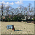
Grazing near Spring Hill, Wolverhampton
This field adjacent to Penn Cemetery shows no signs of new grass growth. Frequent night frosts persisted through into mid-March at the end of the coldest winter in England for over thirty years. The public footpath by the cemetery fence on the right leads into Holden Road. The houses on the right are in Penn Road.
Image: © Roger D Kidd
Taken: 9 Mar 2010
0.13 miles
8
Staffordshire pasture near Spring Hill, Wolverhampton
Looking north-west from the footpath near St Anthony's Care Home. The housing is in Foxlands Avenue, Penn. The fields nearby are also divided into large paddocks, grazed by horses in winter. The edge of Bradney's Wood is on the left.
Image: © Roger Kidd
Taken: 12 Jan 2021
0.13 miles
9
Field and footpath by Penn Cemetery, Wolverhampton
It is worth taking a look at the Google satellite image. The landscaping has surely been done with the idea that this field will eventually become part of the cemetery. The public footpath by the cemetery fence goes into Holden Road through kissing gates at the end of the fence.
Image: © Roger D Kidd
Taken: 9 Mar 2010
0.14 miles
10
Staffordshire pasture near Spring Hill, Wolverhampton
Looking north-west from the footpath near St Anthony's Care Home. The housing is in Foxlands Avenue, Penn. The fields nearby are also divided into large paddocks, grazed by horses.
Image: © Roger Kidd
Taken: 12 Jan 2021
0.14 miles


