
IMAGES TAKEN NEAR TO
Clark Road, WOLVERHAMPTON, WV3 9PB
Introduction
This page details the photographs taken nearby to Clark Road, WV3 9PB by members of the Geograph project.
The Geograph project started in 2005 with the aim of publishing, organising and preserving representative images for every square kilometre of Great Britain, Ireland and the Isle of Man.

There are currently over 7.5m images from over14,400 individuals and you can help contribute to the project by visiting https://www.geograph.org.uk
Image Map
Images are licensed for reuse under creativecommons.org/licenses/by-sa/2.0
Notes
- Clicking on the map will re-center to the selected point.
- The higher the marker number, the further away the image location is from the centre of the postcode.
Image Listing (20 Images Found)
Images are licensed for reuse under creativecommons.org/licenses/by-sa/2.0
Image
Details
Distance
1

Clark Road View
The view at school leaving time, near Compton Road West in Merridale, Wolverhampton.
Image: © Gordon Griffiths
Taken: 10 Nov 2025
0.03 miles
2

Clark Road
The view near Compton Road West in Merridale, Wolverhampton.
Image: © Gordon Griffiths
Taken: 10 Nov 2025
0.08 miles
3
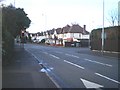
Traffic signals on the Compton Road
Straight on for Compton, turn right for Paget Road and access to the Tettenhall Road at the lights in Park Dale, beside Image
Image: © Richard Law
Taken: 29 Jan 2010
0.10 miles
4
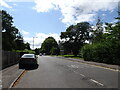
Paget Road View
The view down the Wolverhampton street.
Image: © Gordon Griffiths
Taken: 27 Jul 2023
0.11 miles
5
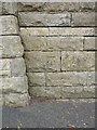
OS benchmark - Merridale, wall on Compton Road
An OS cutmark on the wall on the south side of Compton Road; originally levelled at 121.414m above Ordnance Datum Newlyn.
Image: © Richard Law
Taken: 3 Aug 2015
0.13 miles
6

Clark Road Scene
The view near Compton Road West in Merridale, Wolverhampton.
Image: © Gordon Griffiths
Taken: 10 Nov 2025
0.15 miles
7
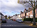
Paget Road
The view down the Wolverhampton street.
Image: © Gordon Griffiths
Taken: 6 Nov 2016
0.15 miles
8
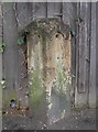
Old Milestone by the A454, Compton Road, Merridale
Stone post (plates lost) by the A454, in parish of Wolverhampton (Wolverhampton District), Merridale, Compton Road, in pavement, on South side of road. Wolverhampton iron plate erected by the Wolverhampton, old district turnpike trust in the 19th century.
Inscription plates once read:-
: (Bridgnorth / 12½) : : (Wolverhampton / 1) :
Wolverhampton and Walsall HER.
HER Number: 13716 https://www.heritagegateway.org.uk/Gateway/Results_Single.aspx?uid=MBL5621&resourceID=1025
Milestone Society National ID: ST_WVBN01
Image: © Mike Faherty
Taken: 14 Mar 2008
0.16 miles
9
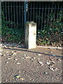
Former milestone at Compton
A much-abused milestone, with its plates missing, which dates from the time that the road was turnpiked in the 19th century. The next one to the west is Image, which is also somewhat dilapidated. After that, the next one is in rather better condition, and is at Image; there are several more in the verge on the way out to Bridgnorth.
Image: © Richard Law
Taken: 30 Aug 2022
0.16 miles
10

Avenue Road
The view near Compton Road West in Finchfield, Wolverhampton.
Image: © Gordon Griffiths
Taken: 10 Nov 2025
0.20 miles