IMAGES TAKEN NEAR TO
Linden Lea, WOLVERHAMPTON, WV3 8BH
Introduction
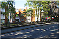
This page details the photographs taken nearby to Linden Lea, WV3 8BH by members of the Geograph project.
The Geograph project started in 2005 with the aim of publishing, organising and preserving representative images for every square kilometre of Great Britain, Ireland and the Isle of Man.

There are currently over 7.5m images from over14,400 individuals and you can help contribute to the project by visiting https://www.geograph.org.uk
Image Map
Images are licensed for reuse under creativecommons.org/licenses/by-sa/2.0
Notes
- Clicking on the map will re-center to the selected point.
- The higher the marker number, the further away the image location is from the centre of the postcode.
Image Listing (46 Images Found)
Images are licensed for reuse under creativecommons.org/licenses/by-sa/2.0
Image
Details
Distance
1
Finchdene Grove
The view in Finchfield, Wolverhampton.
Image: © Gordon Griffiths
Taken: 12 Jun 2020
0.04 miles
2
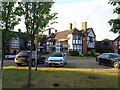
The Spinney
A rather fine example of early 20th century Arts & Crafts design, built in 1907 by the architect William Johnson Harrison Weller, originally as a house for a local man. It has been in use at times as a restaurant and lay empty for much of the 1990s and early 2000s, but is now converted to apartments. Grade II listed https://britishlistedbuildings.co.uk/101262152-the-spinney-tettenhall-wightwick-ward#.Y2mQ43bP3IU & https://historicengland.org.uk/listing/the-list/list-entry/1262152 in 1994.
Image: © Richard Law
Taken: 30 Aug 2022
0.06 miles
3
Finchfield Road West
Quite a leafy part.
Image: © Bill Boaden
Taken: 22 Jun 2018
0.08 miles
4
Block of flats on Finchfield Road West
Blocks of private flats often collect lines of sale boards outside.
Image: © Bill Boaden
Taken: 22 Jun 2018
0.09 miles
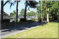
5
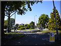
From the north end of Coppice Road, Finchfield
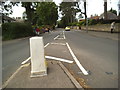
This junction was the terminus of Wolverhampton Corporation trolleybus route 12; the trolleybuses turned left into Coppice Road (foreground), then reversed highly awkwardly across the oncoming traffic into Castlecroft Road (left distance) before heading back to town. The other reversing triangles on the Wolverhampton system were arranged so that the trolleybuses reversed into side streets on the nearside rather than out of them. The roundabout containing the very lush tree (right) was constructed on the site of the New Inn, which was demolished in the 1970s.
Image: © Richard Vince
Taken: 6 Jun 2013
0.11 miles
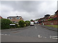
6
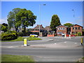
East end of Castlecroft Road, Finchfield
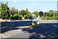
Heading west here, the road forks, with Castlecroft Road (foreground) diverging from Finchfield Road West. The junction was formerly a little way further east; the demolition of the New Inn in the 1970s allowed the installation of a roundabout, just out of frame to the right. The terminus of Wolverhampton Corporation trolleybus route 12 was about here; the trolleybuses turned left into Coppice Road (to the right of the photographer), then reversed highly awkwardly across the oncoming traffic into Castlecroft Road before heading back to town. The other reversing triangles on the Wolverhampton system were arranged so that the trolleybuses reversed into side streets on the nearside rather than out of them.
Image: © Richard Vince
Taken: 6 Jun 2013
0.12 miles
7
York Avenue
The view along the avenue in Finchfield, Wolverhampton.
Image: © Gordon Griffiths
Taken: 3 Feb 2019
0.13 miles
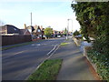
8
Finchfield Road West
The view near Bantock Park at the junction with Broad Lane, Wolverhampton.
Image: © Gordon Griffiths
Taken: 29 Jun 2013
0.13 miles
9
Roundabout on Finchfield Road
Bantock Park begins on the right.
Image: © Bill Boaden
Taken: 22 Jun 2018
0.14 miles