East end of Castlecroft Road, Finchfield
Introduction
The photograph on this page of East end of Castlecroft Road, Finchfield by Richard Vince as part of the Geograph project.
The Geograph project started in 2005 with the aim of publishing, organising and preserving representative images for every square kilometre of Great Britain, Ireland and the Isle of Man.

There are currently over 7.5m images from over 14,400 individuals and you can help contribute to the project by visiting https://www.geograph.org.uk
East end of Castlecroft Road, Finchfield
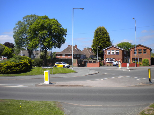
Image: © Richard Vince Taken: 6 Jun 2013
Heading west here, the road forks, with Castlecroft Road (foreground) diverging from Finchfield Road West. The junction was formerly a little way further east; the demolition of the New Inn in the 1970s allowed the installation of a roundabout, just out of frame to the right. The terminus of Wolverhampton Corporation trolleybus route 12 was about here; the trolleybuses turned left into Coppice Road (to the right of the photographer), then reversed highly awkwardly across the oncoming traffic into Castlecroft Road before heading back to town. The other reversing triangles on the Wolverhampton system were arranged so that the trolleybuses reversed into side streets on the nearside rather than out of them.
Images are licensed for reuse under creativecommons.org/licenses/by-sa/2.0
Image Location
Latitude
52.579601
Longitude
-2.16952