
IMAGES TAKEN NEAR TO
Victoria Road, BRIDGNORTH, WV16 4LD
Introduction
This page details the photographs taken nearby to Victoria Road, WV16 4LD by members of the Geograph project.
The Geograph project started in 2005 with the aim of publishing, organising and preserving representative images for every square kilometre of Great Britain, Ireland and the Isle of Man.

There are currently over 7.5m images from over14,400 individuals and you can help contribute to the project by visiting https://www.geograph.org.uk
Image Map
Images are licensed for reuse under creativecommons.org/licenses/by-sa/2.0
Notes
- Clicking on the map will re-center to the selected point.
- The higher the marker number, the further away the image location is from the centre of the postcode.
Image Listing (46 Images Found)
Images are licensed for reuse under creativecommons.org/licenses/by-sa/2.0
Image
Details
Distance
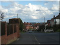
2
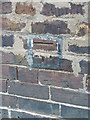
OS benchmark - Bridgnorth, no 28 Victoria Road
OS cutmark in the brickwork at the side of no 28 Victoria Road; originally levelled at 76.779m above Ordnance Datum Newlyn.
Image: © Richard Law
Taken: 7 Dec 2013
0.05 miles
4
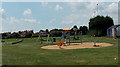
Children's play area on an NPFA field in Bridgnorth
On the south side of Innage Lane, near AFC Bridgnorth's Crown Meadow ground.
NPFA is National Playing Fields Association. http://www.geograph.org.uk/photo/4054371
Image: © Jaggery
Taken: 2 Jul 2014
0.10 miles
5
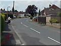
Orchard Drive, Bridgnorth
From the corner of Innage Lane.
Image: © Jaggery
Taken: 2 Jul 2014
0.10 miles
7
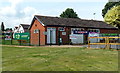
AFC Bridgnorth clubhouse, Bridgnorth
On the Innage Lane side of the football club's ground at Crown Meadow.
Image: © Jaggery
Taken: 2 Jul 2014
0.11 miles
8
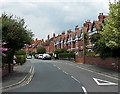
Victoria Road, Bridgnorth
Houses at the southern end of Victoria Road, viewed from the B4364 Salop Street.
Image: © Jaggery
Taken: 2 Jul 2014
0.11 miles
9

3 - 27 Victoria Road
Three similar late 19th Century terraces on Victoria Road, each consisting of four houses. Although these houses are first shown on the 1903 25" map, the road itself is earlier, being shown on the 1884 1:500 plan named Hookfield Lane.
Image: © Ian Capper
Taken: 10 May 2023
0.12 miles
10
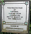
NPFA sign in Bridgnorth
Located near this http://www.geograph.org.uk/photo/4054368 children's play area.
NPFA is National Playing Fields Association.
Image: © Jaggery
Taken: 2 Jul 2014
0.12 miles