
IMAGES TAKEN NEAR TO
Pale Meadow Road, BRIDGNORTH, WV15 6BE
Introduction
This page details the photographs taken nearby to Pale Meadow Road, WV15 6BE by members of the Geograph project.
The Geograph project started in 2005 with the aim of publishing, organising and preserving representative images for every square kilometre of Great Britain, Ireland and the Isle of Man.

There are currently over 7.5m images from over14,400 individuals and you can help contribute to the project by visiting https://www.geograph.org.uk
Image Map
Images are licensed for reuse under creativecommons.org/licenses/by-sa/2.0
Notes
- Clicking on the map will re-center to the selected point.
- The higher the marker number, the further away the image location is from the centre of the postcode.
Image Listing (485 Images Found)
Images are licensed for reuse under creativecommons.org/licenses/by-sa/2.0
Image
Details
Distance
1
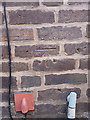
OS benchmark - Bridgnorth, nos 9 & 10, Severn Street
OS cutmark on the frontage between two houses on Severn Street; originally levelled at 33.583m above Ordnance Datum Newlyn.
Image: © Richard Law
Taken: 30 Dec 2013
0.07 miles
2
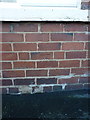
OS benchmark - Bridgnorth, no 50 Severn Street
OS cutmark on the front wall of no 50, Severn Street; originally levelled at 33.68m above Ordnance Datum Newlyn.
Image: © Richard Law
Taken: 30 Dec 2013
0.07 miles
4
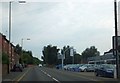
Ford car showroom, Bridgnorth
On Hospital Street, Low Town, Bridgnorth. Opposite is a short terrace of brick cottages.
Image: © David Smith
Taken: 23 Jul 2013
0.08 miles
5
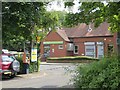
Car park, Low Town
Bridgnorth's Jobcentre is behind the bandit.
Image: © Richard Webb
Taken: 30 Jun 2014
0.09 miles
6
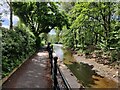
The Geopark Way in Bridgnorth
On the right is the Bylet, an island in the River Severn.
Image: © Mat Fascione
Taken: 7 May 2023
0.09 miles
7
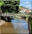
Terriers Bridge in Bridgnorth
The bridge was constructed in the winter of 2004-5, it connects the Bylet island with Severn Side South, crossing the River Severn. The Bylet has a bowling club on it.
Image: © Mat Fascione
Taken: 7 May 2023
0.10 miles
8
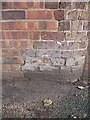
OS benchmark - Bridgnorth, no 2 Severn Side South
An OS cutmark in the roadside wall outside no 2; originally levelled at 31.41m above Ordnance Datum Newlyn.
Image: © Richard Law
Taken: 25 Jan 2014
0.11 miles
9

Terrace of houses above Hospital Street, Bridgnorth
Image: © Richard Law
Taken: 21 Aug 2025
0.11 miles
10
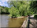
The Bylet on the River Severn
The Bylet is a small island in the River Severn at Bridgnorth. It contains a bowling club, connected to Severn Side South by the Terriers Bridge. The path on the right is the Geopark Way.
Image: © Mat Fascione
Taken: 7 May 2023
0.11 miles