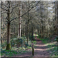
1
Mobile Homes near Quatford, Shropshire
The homes are overlooked by low sandstone cliffs and woodland.
Image: © Roger Kidd
Taken: 20 Apr 2007
0.01 miles
2
Dudmaston Comer Woods in Shropshire
This is a National Trust owned area of woodland and forest near Quatford. Hollins Park mobile homs park is adjacent.
Image: © Roger Kidd
Taken: 26 Mar 2022
0.05 miles
3
Woodland track south-east of Quatford in Shropshire
Looking west. This track is a public footpath. There are many other paths and tracks, waymarked and not, wide and narrow in these very attractive and popular woods.
The extensive Dudmaston Comer Woods (National Trust) effectively include the whole Heath Plantation which covers much of the previous Heath Farm land. https://www.nationaltrust.org.uk/dudmaston/features/connecting-comer-wood
Image: © Roger Kidd
Taken: 26 Mar 2022
0.11 miles
4
National Trust car park at Comer Woods
Part of the Dudmaston Estate.
Image: © Mat Fascione
Taken: 23 Apr 2021
0.11 miles
5
Dudmaston Comer Woods near Quatford in Shropshire
Looking north-east, this is the main walk in to the very popular Dudmaston Comer Woods, which belong to the National Trust. There are many waymarked (and un-signed) paths, wide and narrow, in the very attractive woods. The plantation here is on formerly open fields around Heath Farm. The long distance Geopark Way passes through the western part of the forest. The remaining barns here provide National Trust visitor facilities.
https://www.nationaltrust.org.uk/dudmaston/features/connecting-comer-wood
https://ldwa.org.uk/ldp/members/show_path.php?path_name=Geopark+Way
Image: © Roger Kidd
Taken: 19 Mar 2022
0.12 miles
6
Dudmaston Comer Woods near Quatford in Shropshire
Looking north-east, this is the main walk in to the very popular Dudmaston Comer Woods, which belong to the National Trust. There are many waymarked (and un-signed) paths, wide and narrow, in the very attractive woods. The plantation here is on formerly open fields around Heath Farm. The long distance Geopark Way passes through the western part of the forest. The remaining barns here provide National Trust visitor facilities.
https://www.nationaltrust.org.uk/dudmaston/features/connecting-comer-wood
https://ldwa.org.uk/ldp/members/show_path.php?path_name=Geopark+Way
Image: © Roger Kidd
Taken: 19 Mar 2022
0.13 miles
7
Footpath in Dudmaston Comer Woods, Shropshire
Looking east.
The extensive Dudmaston Comer Woods (National Trust) effectively include the whole Heath Plantation which covers much of the previous Heath Farm land. https://www.nationaltrust.org.uk/dudmaston/features/connecting-comer-wood
There are many other waymarked (and un-signed) paths, wide and narrow, in these very attractive woods.
Image: © Roger Kidd
Taken: 26 Mar 2022
0.13 miles
8
Track & bridleway to Heath Farm
Image: © Richard Law
Taken: 27 Jul 2011
0.14 miles
9
Footpath in Dudmaston Comer Woods, Shropshire
Looking west.
The extensive Dudmaston Comer Woods (National Trust) effectively include the whole Heath Plantation which covers much of the previous Heath Farm land. https://www.nationaltrust.org.uk/dudmaston/features/connecting-comer-wood
Image: © Roger Kidd
Taken: 26 Mar 2022
0.16 miles
10
Waymarked track in Dudmaston Comer Woods, Shropshire
Looking west near Quatford. This track is also a public footpath from Mose. There are many other paths and tracks, waymarked and not, wide and narrow in these very attractive and popular woods. There are also several wide and well maintained paths accessible to wheelchairs, and visitor facilities at Heath Meadow.
The extensive Dudmaston Comer Woods (National Trust) effectively include the whole Heath Plantation which covers much of the previous Heath Farm land. https://www.nationaltrust.org.uk/dudmaston/features/connecting-comer-wood
Image: © Roger Kidd
Taken: 26 Mar 2022
0.16 miles


