
IMAGES TAKEN NEAR TO
Worfield, BRIDGNORTH, WV15 5NT
Introduction
This page details the photographs taken nearby to WV15 5NT by members of the Geograph project.
The Geograph project started in 2005 with the aim of publishing, organising and preserving representative images for every square kilometre of Great Britain, Ireland and the Isle of Man.

There are currently over 7.5m images from over14,400 individuals and you can help contribute to the project by visiting https://www.geograph.org.uk
Image Map
Images are licensed for reuse under creativecommons.org/licenses/by-sa/2.0
Notes
- Clicking on the map will re-center to the selected point.
- The higher the marker number, the further away the image location is from the centre of the postcode.
Image Listing (28 Images Found)
Images are licensed for reuse under creativecommons.org/licenses/by-sa/2.0
Image
Details
Distance
1

Shropshire farmland north-east of Worfield
The spire of St Peter's Church in Worfield can be seen just under a mile away. Red-brick buildings around Rowley Farm are a quarter of a mile away.
Image: © Roger D Kidd
Taken: 29 Apr 2025
0.02 miles
2

Driveway to Rowley House near Bradney in Shropshire
Image: © Roger D Kidd
Taken: 29 Apr 2025
0.06 miles
3
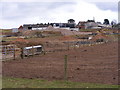
Rowley Farm
The Farm near Worfield Village.
Image: © Gordon Griffiths
Taken: 12 Mar 2010
0.06 miles
4
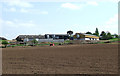
Ploughed Field and Rowley Farm, Bradney, Shropshire
Image: © Roger Kidd
Taken: 26 Apr 2007
0.07 miles
6

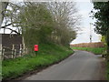
Lane north-east out of Bradney in Shropshire
The lane from Wyken leads towards Chesterton.
Image: © Roger D Kidd
Taken: 29 Apr 2025
0.11 miles
7

Road to Worfield in Shropshire
This is at Bradney, looking south-west towards Wyken and Worfield.
Image: © Roger D Kidd
Taken: 29 Apr 2025
0.12 miles
8

Pasture but no bridleway near Bradney in Shropshire
The bridleway is mapped alongside the lane hedge on the right, and the rider friendly gate onto the lane is still there, but behind the camera the land has been divided into (sometimes temporary) paddocks, and all gate access to the arable fields north-west of here has been eliminated.
Image: © Roger D Kidd
Taken: 29 Apr 2025
0.14 miles
9

Road to Rowley Farm near Worfield in Shropshire
The unsurfaced road leads west-south-west to the farm and various additional residential buildings and conversions.
Image: © Roger D Kidd
Taken: 29 Apr 2025
0.15 miles
10

Lane south-west from Bradney in Shropshire
The lane leads towrds Wyken and Worfield.
Image: © Roger D Kidd
Taken: 29 Apr 2025
0.15 miles