
IMAGES TAKEN NEAR TO
Haden Hill, BRIDGNORTH, WV15 5LL
Introduction
This page details the photographs taken nearby to Haden Hill, WV15 5LL by members of the Geograph project.
The Geograph project started in 2005 with the aim of publishing, organising and preserving representative images for every square kilometre of Great Britain, Ireland and the Isle of Man.

There are currently over 7.5m images from over14,400 individuals and you can help contribute to the project by visiting https://www.geograph.org.uk
Image Map
Images are licensed for reuse under creativecommons.org/licenses/by-sa/2.0
Notes
- Clicking on the map will re-center to the selected point.
- The higher the marker number, the further away the image location is from the centre of the postcode.
Image Listing (13 Images Found)
Images are licensed for reuse under creativecommons.org/licenses/by-sa/2.0
Image
Details
Distance
1
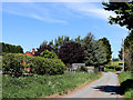
Stableford Road west of Ackleton in Shropshire
Looking north near Jay's Farm.
Image: © Roger Kidd
Taken: 19 May 2020
0.02 miles
2
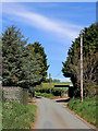
Stableford Road west of Ackleton in Shropshire
Looking north near Jay's Farm.
Image: © Roger Kidd
Taken: 19 May 2020
0.02 miles
3
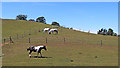
Grazing on Haden Hill west of Ackleton, Shropshire
Looking west. Much of the pasture on both sides of Stableford Road is divided into paddocks for horse grazing.
Image: © Roger Kidd
Taken: 19 May 2020
0.06 miles
4
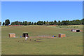
Shropshire pasture south-west of Ackleton
This telephoto assisted image shows part of the wider landscape seen here: https://www.geograph.org.uk/photo/6484157
The ground is very dry following several weeks of warm weather with very little rain.
Image: © Roger Kidd
Taken: 19 May 2020
0.06 miles
5
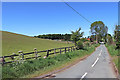
Stableford Road near Ackleton in Shropshire
The pasture to the left is on the eastern slopes of Haden Hill. Stableford Road leads past Stableford to the village of Badger.
Image: © Roger Kidd
Taken: 19 May 2020
0.08 miles
6
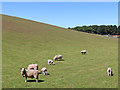
Grazing on Haden Hill in Shropshire
This is south-west of Ackleton, seen by looking north-west at the eastern slopes of Haden Hill from Stableford Road near the junction with the B4176.
Image: © Roger Kidd
Taken: 19 May 2020
0.10 miles
7
Pasture south-west of Ackleton in Shropshire
Looking north-east from Stableford Road near the junction with the A4176.
Image: © Roger Kidd
Taken: 19 May 2020
0.10 miles


10
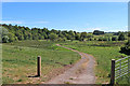
Shropshire farmland south west of Ackleton
Looking south-east from the B4176 near the junction with Stableford Road. The woodland on the left is Weirhill Plantation, leading to Folley Coppice.
Image: © Roger Kidd
Taken: 19 May 2020
0.20 miles