IMAGES TAKEN NEAR TO
The Paddock, BILSTON, WV14 8XX
Introduction
This page details the photographs taken nearby to The Paddock, WV14 8XX by members of the Geograph project.
The Geograph project started in 2005 with the aim of publishing, organising and preserving representative images for every square kilometre of Great Britain, Ireland and the Isle of Man.

There are currently over 7.5m images from over14,400 individuals and you can help contribute to the project by visiting https://www.geograph.org.uk
Image Map
Images are licensed for reuse under creativecommons.org/licenses/by-sa/2.0
Notes
- Clicking on the map will re-center to the selected point.
- The higher the marker number, the further away the image location is from the centre of the postcode.
Image Listing (98 Images Found)
Images are licensed for reuse under creativecommons.org/licenses/by-sa/2.0
Image
Details
Distance
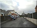
1
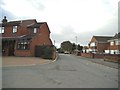
The Paddock
The view down The Paddock Coseley, Dudley.
Image: © Gordon Griffiths
Taken: 19 Dec 2014
0.03 miles
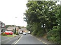
2
Southall Crescent Path
The view up the path off Southall Crescent in Coseley, Dudley.
Image: © Gordon Griffiths
Taken: 29 Aug 2015
0.04 miles
3
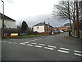
Southall Crescent Junction
The view of the junction with The Paddock Coseley, Dudley.
Image: © Gordon Griffiths
Taken: 19 Dec 2014
0.05 miles
4
The Paddock Scene
The view down The Paddock Coseley, Dudley.
Image: © Gordon Griffiths
Taken: 19 Dec 2014
0.05 miles
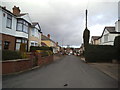
5
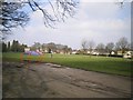
The Paddock View
The view down The Paddock towards the Clayton Playing Fields in Coseley, Dudley.
Image: © Gordon Griffiths
Taken: 19 Dec 2014
0.06 miles
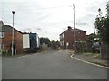
6
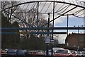
Station Car Park
The view of Coseley Railway Station Car Park in Dudley.
Image: © Gordon Griffiths
Taken: 19 Dec 2014
0.08 miles
7
Gough Road Junction
The view of the junction with Webb Street, Coseley.
Image: © Gordon Griffiths
Taken: 31 Jul 2015
0.09 miles
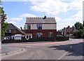
8
Coseley Cricket Club
The road on the north side is called 'The Paddock', so it may well have been grazing land until the cricketers took possession.
Image: © Richard Law
Taken: 19 Dec 2008
0.09 miles
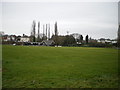
9
Coseley Recreation grounds
My 1:25,000 map marks this site as having a Liby on it. Clearly this is no longer the case, although it could well have been where the foreground hard-surface area now sits.
Image: © Richard Law
Taken: 5 Mar 2009
0.10 miles
10
Ribbesford Crescent
The view of the crescent alongside Christ Church Graveyard in Coseley, Dudley.
Image: © Gordon Griffiths
Taken: 29 Aug 2015
0.10 miles