IMAGES TAKEN NEAR TO
Lowbridge Walk, BILSTON, WV14 6BJ
Introduction
This page details the photographs taken nearby to Lowbridge Walk, WV14 6BJ by members of the Geograph project.
The Geograph project started in 2005 with the aim of publishing, organising and preserving representative images for every square kilometre of Great Britain, Ireland and the Isle of Man.

There are currently over 7.5m images from over14,400 individuals and you can help contribute to the project by visiting https://www.geograph.org.uk
Image Map
Images are licensed for reuse under creativecommons.org/licenses/by-sa/2.0
Notes
- Clicking on the map will re-center to the selected point.
- The higher the marker number, the further away the image location is from the centre of the postcode.
Image Listing (215 Images Found)
Images are licensed for reuse under creativecommons.org/licenses/by-sa/2.0
Image
Details
Distance
2
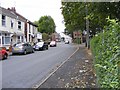
Green Lanes Scene
The view in Bilston, Wolverhampton.
Image: © Gordon Griffiths
Taken: 20 Jun 2017
0.02 miles
3
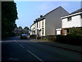
Green Lanes View
The view in Bilston.
Image: © Gordon Griffiths
Taken: 1 Aug 2024
0.02 miles
4
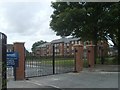
School Flats Gate
The gate to the new apartments on the former Bilston Girls High School playing field off Claremont Street.
Image: © Gordon Griffiths
Taken: 28 Sep 2009
0.03 miles
5
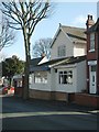
Haven Hotel
The Hotel in Claremont Street.
Image: © Gordon Griffiths
Taken: 26 Feb 2008
0.03 miles
6
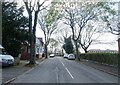
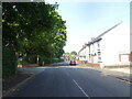
Claremont Street
The view in Bilston.
Image: © Gordon Griffiths
Taken: 20 Apr 2022
0.04 miles
7
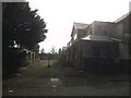
Derelict Hotel
The view of the former Haven Hotel in Claremont Street, Bilston.
Image: © Gordon Griffiths
Taken: 15 Sep 2016
0.04 miles
8
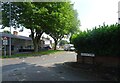
Claremont Street View
The view in Bilston.
Image: © Gordon Griffiths
Taken: 1 Aug 2024
0.05 miles
9
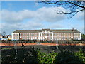
Bilston Girls High School
This former School on the Wellington Road is being changed to housing.
Image: © Gordon Griffiths
Taken: 26 Feb 2008
0.05 miles
10
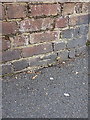
OS benchmark - Bilston, Claremont Street and Green Lanes
An OS cutmark (half of one, at any rate) very low in the wall on the SE side of Claremont St & Green Lane. The rest of it has been buried in the paving. Originally levelled at 138.526m above Ordnance Datum Newlyn.
Image: © Richard Law
Taken: 1 Sep 2013
0.05 miles