OS benchmark - Bilston, Claremont Street and Green Lanes
Introduction
The photograph on this page of OS benchmark - Bilston, Claremont Street and Green Lanes by Richard Law as part of the Geograph project.
The Geograph project started in 2005 with the aim of publishing, organising and preserving representative images for every square kilometre of Great Britain, Ireland and the Isle of Man.

There are currently over 7.5m images from over 14,400 individuals and you can help contribute to the project by visiting https://www.geograph.org.uk
OS benchmark - Bilston, Claremont Street and Green Lanes
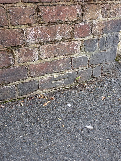
Image: © Richard Law Taken: 1 Sep 2013
An OS cutmark (half of one, at any rate) very low in the wall on the SE side of Claremont St & Green Lane. The rest of it has been buried in the paving. Originally levelled at 138.526m above Ordnance Datum Newlyn.
Images are licensed for reuse under creativecommons.org/licenses/by-sa/2.0
Image Location
Latitude
52.569904
Longitude
-2.082197