IMAGES TAKEN NEAR TO
Willenhall Road, WOLVERHAMPTON, WV1 2HY
Introduction
This page details the photographs taken nearby to Willenhall Road, WV1 2HY by members of the Geograph project.
The Geograph project started in 2005 with the aim of publishing, organising and preserving representative images for every square kilometre of Great Britain, Ireland and the Isle of Man.

There are currently over 7.5m images from over14,400 individuals and you can help contribute to the project by visiting https://www.geograph.org.uk
Image Map
Images are licensed for reuse under creativecommons.org/licenses/by-sa/2.0
Notes
- Clicking on the map will re-center to the selected point.
- The higher the marker number, the further away the image location is from the centre of the postcode.
Image Listing (46 Images Found)
Images are licensed for reuse under creativecommons.org/licenses/by-sa/2.0
Image
Details
Distance
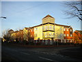
1
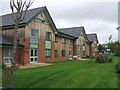
St Matthews Place on Willenhall Road
A development by Focus Housing this provides facilities for independent living for frail older people as an alternative to care or nursing homes. The outside of the building features the current fashion for timber cladding. I am not sure that this really suits a building of this size in an urban environment.
Image: © John M
Taken: 1 Oct 2006
0.07 miles
2
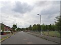
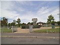
Mayfield Road Scene
The view from Mayfield Road in East Park, Wolverhampton.
Image: © Gordon Griffiths
Taken: 29 Jul 2022
0.08 miles
3
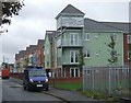
Apartment living on Willenhall Road
Multi-colour apartments with token balconies. I can't see what the architect was trying to achieve here with the gavanised metalwork construction at roof level.
Image: © John M
Taken: 1 Oct 2006
0.08 miles
4
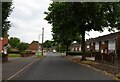
Mayfield Road View
The view by Woodstock Road near East Park in Wolverhampton.
Image: © Gordon Griffiths
Taken: 29 Jul 2022
0.10 miles
5
Mayfield park
The view from Mayfield Road in East Park, Wolverhampton.
Image: © Gordon Griffiths
Taken: 26 May 2014
0.10 miles
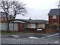
6
Sheltered housing off Willenhall Road
Small terrace of sheltered housing.
Image: © John M
Taken: 1 Oct 2006
0.11 miles
7
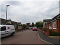
Mayfield Road Close
The view off Mayfield Road in East Park, Wolverhampton.
Image: © Gordon Griffiths
Taken: 29 Jul 2022
0.11 miles
8
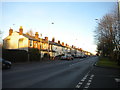
Willenhall Road, Wolverhampton
Looking towards Willenhall from the junction with East Park Way.
Image: © Richard Vince
Taken: 23 Dec 2017
0.11 miles
9
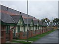
Council Housing - Mayfield Road
Rare survivor of the immediate post-war Tarran pre-fab bungalows.
Image: © John M
Taken: 21 Apr 2013
0.11 miles
10
Block of flats, East Park Way, Wolverhampton
On the corner of Mayfield Road. In the early 2000s, this block and others replaced the earlier low rise flats that previously stood between Mayfield Road and Willenhall Road.
Image: © Richard Vince
Taken: 23 Dec 2017
0.12 miles