1
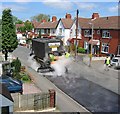
Woden Avenue, Wednesfield
Image: © Richard Webb
Taken: 13 Apr 2016
0.05 miles
2
Polling Station - Wolverhampton North East
Wodensfelde Primary School plays host to a polling station for the 2010 General Election. The school is in a post war Council Estate many of the houses have been purchased under 'Right to Buy' schemes. The demographic is working class.
Image: © John M
Taken: 6 May 2010
0.05 miles
3
Resurfacing Vicarage Road
Vicarage Road, Wednesfield getting a new coat of bitumen and chippings.
Image: © Richard Webb
Taken: 18 May 2004
0.14 miles
4
Pillar box, Vicarage Road (Wednesfield)
Outside what was once a corner shop. The shop was famous for hardly ever having any stock, we were constantly reminded of it when on holiday in Romania just after the coup in 1989.
Image: © Richard Webb
Taken: 1 May 2010
0.15 miles
5
Vicarage Road in Spring
The northern half of the street is a mix of sometimes damp terraced houses (built 1895) and former council stock. Houses with a roof over their door would have been municipal stock around 1990 when the council houses were refurbished. Right to buy houses would have missed this.
Image: © Richard Webb
Taken: 1 May 2010
0.15 miles
6
No Poll Tax
Image: © Richard Webb
Taken: Unknown
0.15 miles
7
Wednesfield, resource centre
Woden Community Resource Centre, on Vicarage Road; offering daycare, respite and rehabilitation services. http://www.wolverhampton.gov.uk/health_social_care_2/adult_social_care/older_people/care_home/resource_centres/woden.htm
Image: © Mike Faherty
Taken: 13 Oct 2011
0.15 miles
8
Vicarage Road, Wednesfield
Tree lined residential street, although infamously one of the trees did once end up in somebody's house. The flats are now blue.
Image: © Richard Webb
Taken: 13 Apr 2016
0.15 miles
9
Memories of the 'Cottage Homes'
A modern housing estate now occupies the site of the 'Cottage Homes'. These homes originally housed pauper children and were later used as local authority children's homes before closing in the 1960s.
For further details see
http://www.workhouses.org.uk/index.html?Wolverhampton/Wolverhampton.shtml
Image: © John M
Taken: 24 Jun 2007
0.15 miles
10
Vicarage Road in Spring
The southern part of the street has large detached or semi detached houses while around the corner is a mix of old council stock and 1890s terraces. At least one of these terraces is rather damp.
The trees have mostly survived despite fears of root damage when cable TV was installed in the early 1990's. There was one about where I was standing, but it fell victim to a storm.
Image: © Richard Webb
Taken: 1 May 2010
0.16 miles


