IMAGES TAKEN NEAR TO
Elton Close, WOLVERHAMPTON, WV10 8TF
Introduction
This page details the photographs taken nearby to Elton Close, WV10 8TF by members of the Geograph project.
The Geograph project started in 2005 with the aim of publishing, organising and preserving representative images for every square kilometre of Great Britain, Ireland and the Isle of Man.

There are currently over 7.5m images from over14,400 individuals and you can help contribute to the project by visiting https://www.geograph.org.uk
Image Map
Images are licensed for reuse under creativecommons.org/licenses/by-sa/2.0
Notes
- Clicking on the map will re-center to the selected point.
- The higher the marker number, the further away the image location is from the centre of the postcode.
Image Listing (23 Images Found)
Images are licensed for reuse under creativecommons.org/licenses/by-sa/2.0
Image
Details
Distance
1
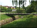
Footbridge over the Waterhead Brook
The brook passes through an area of 1980s housing providing a pleasant green corridor.
Image: © John M
Taken: 6 Jun 2010
0.10 miles
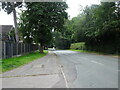
3
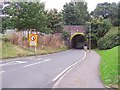
Greenfield Lane, Wolverhampton
Typical of most of the narrow and low headroom bridges under the Wolverhampton to Stafford line. These catch out the occasional high vehicles and can sometimes flood in heavy rainfall.
Image: © Adrian Bailey
Taken: 11 Oct 2005
0.10 miles
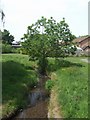
4
Waterhead Brook downstream of Cavalier Crescent
Image: © John M
Taken: 6 Jun 2010
0.12 miles
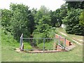
5
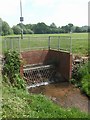
Culvert on the Waterhead Brook
The brook is culverted under a corner of the open space.
Image: © John M
Taken: 6 Jun 2010
0.13 miles
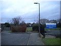
6
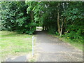
Footpath Scene
The view off Abbeyfield Road in Bushbury, Wolverhampton.
Image: © Gordon Griffiths
Taken: 1 Aug 2024
0.13 miles
7
Waterhead Brook beside the WCML
The brook flows between housing and the Wolverhampton to Stafford railway, part of the West Coast Main Line.
Image: © John M
Taken: 6 Jun 2010
0.14 miles
8
Greenfield lane
The view in Bushbury, Wolverhampton.
Image: © Gordon Griffiths
Taken: 1 Aug 2024
0.14 miles
9
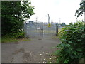
Substation View
The view in Bushbury, Wolverhampton.
Image: © Gordon Griffiths
Taken: 1 Aug 2024
0.15 miles
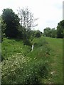
10
North end of Cromwell Road, Northwood Park
Effectively continuing as a public bridleway called Primrose Lane.
Image: © Richard Vince
Taken: 24 Dec 2017
0.15 miles