IMAGES TAKEN NEAR TO
Masefield Mews, WOLVERHAMPTON, WV10 8SB
Introduction
This page details the photographs taken nearby to Masefield Mews, WV10 8SB by members of the Geograph project.
The Geograph project started in 2005 with the aim of publishing, organising and preserving representative images for every square kilometre of Great Britain, Ireland and the Isle of Man.

There are currently over 7.5m images from over14,400 individuals and you can help contribute to the project by visiting https://www.geograph.org.uk
Image Map
Images are licensed for reuse under creativecommons.org/licenses/by-sa/2.0
Notes
- Clicking on the map will re-center to the selected point.
- The higher the marker number, the further away the image location is from the centre of the postcode.
Image Listing (37 Images Found)
Images are licensed for reuse under creativecommons.org/licenses/by-sa/2.0
Image
Details
Distance
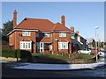
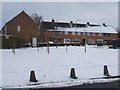
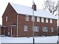
1
Council Housing - Masefield Road
Evidence here of a Council house sale on the 1937 Scotlands Estate. The nearest property was excluded from the latest modernisation and re-roofing works.
Image: © John M
Taken: 20 Dec 2009
0.05 miles
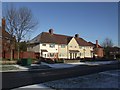
2
Council Housing - Newman Road
Large semi-detached house on a corner plot on the 1937 Scotlands Estate.
Image: © John M
Taken: 20 Dec 2009
0.10 miles
3
Council Housing - Keats Road
A mixture of styles on the 1937 Scotlands Estate
Image: © John M
Taken: 20 Dec 2009
0.11 miles
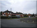
4
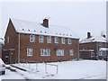
Council Housing - Cannock Road
Post war, early 1950s, housing on the Underhill Estate.
Image: © John M
Taken: 20 Jan 2013
0.15 miles
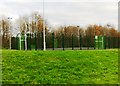
5
Council Housing - Westcroft Avenue
The latest attempt to plant trees on the open space will probably fail when the weather brightens up and the natives come out to play.
Image: © John M
Taken: 25 Mar 2013
0.16 miles
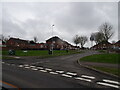
6
South end of Wildtree Avenue, Underhill estate
Seen from Westcroft Avenue.
Image: © Richard Vince
Taken: 10 Jan 2014
0.18 miles
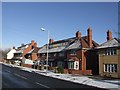
7
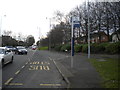
Former bus turning circle, Cannock Road, Underhill
Now partly built over in the foreground, this patch of road was once used as a turning circle by trolleybuses (latterly on routes 12 and 13). The destination shown was "Low Hill (Pear Tree)", the Pear Tree being a pub out of frame to the left; nowadays, Low Hill is more associated with the interwar housing estate a mile or two west of here, and in fact the 1950s Underhill estate just reaches Cannock Road here (right). Nowadays, the main bus service along Cannock Road goes into the estate, leaving only the out of town route to Cannock serving this stop.
Image: © Richard Vince
Taken: 10 Jan 2014
0.18 miles
9
Council Housing - Westcroft Avenue
Early 1950s housing on the Underhill Estate.
Image: © John M
Taken: 24 Dec 2010
0.19 miles
10
Pope Road
The view from Underhill Lane in Bushbury, Wolverhampton.
Image: © Gordon Griffiths
Taken: 20 Mar 2023
0.19 miles