IMAGES TAKEN NEAR TO
South View Close, WOLVERHAMPTON, WV10 7QA
Introduction
This page details the photographs taken nearby to South View Close, WV10 7QA by members of the Geograph project.
The Geograph project started in 2005 with the aim of publishing, organising and preserving representative images for every square kilometre of Great Britain, Ireland and the Isle of Man.

There are currently over 7.5m images from over14,400 individuals and you can help contribute to the project by visiting https://www.geograph.org.uk
Image Map
Images are licensed for reuse under creativecommons.org/licenses/by-sa/2.0
Notes
- Clicking on the map will re-center to the selected point.
- The higher the marker number, the further away the image location is from the centre of the postcode.
Image Listing (28 Images Found)
Images are licensed for reuse under creativecommons.org/licenses/by-sa/2.0
Image
Details
Distance
1

Whitgreave Primary School
Featherstone was the mining village for the nearby Hilton Main Colliery. The shaft was sunk in the interwar period. The pit closed in the late 1960s. The school has seen a new influx as housing estates were built around the village. A new school would be required if the latest proposals for a further 1000 homes are approved.
Image: © John M
Taken: 22 Jul 2007
0.09 miles
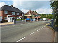
2
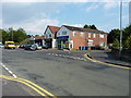
Shops on The Avenue
Small businesses in Featherstone.
Image: © Richard Law
Taken: 18 Jun 2014
0.10 miles
3
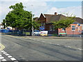
Whitgreave Primary School
The village primary for Featherstone, which would originally have served the children of miners at the Hilton Main colliery.
Image: © Richard Law
Taken: 18 Jun 2014
0.12 miles
6
Brookhouse Lane becomes The Avenue
Heading east towards the older part of Featherstone village.
Image: © Richard Law
Taken: 18 Jun 2014
0.14 miles
7
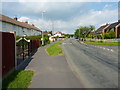
The Avenue
1950s semi-detached housing lines the north side of The Avenue, which runs between Brookhouse Lane in the west, and the main Cannock Road to the east.
Image: © Richard Law
Taken: 18 Jun 2014
0.14 miles
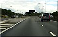
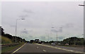
9
M54 motorway - lane drop at junction 1
The main line of the motorway continues as a two-lane formation to its end at the M6.
Image: © Peter Whatley
Taken: 8 Jun 2013
0.15 miles
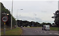
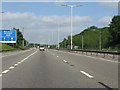
10
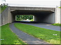
A rare quiet moment
Unusually low traffic volumes at this normally very busy interchange, where the A460 Cannock Road goes under the M54.
Image: © Richard Law
Taken: 18 Jun 2014
0.16 miles