IMAGES TAKEN NEAR TO
Stafford Road, WOLVERHAMPTON, WV10 6DE
Introduction
This page details the photographs taken nearby to Stafford Road, WV10 6DE by members of the Geograph project.
The Geograph project started in 2005 with the aim of publishing, organising and preserving representative images for every square kilometre of Great Britain, Ireland and the Isle of Man.

There are currently over 7.5m images from over14,400 individuals and you can help contribute to the project by visiting https://www.geograph.org.uk
Image Map
Images are licensed for reuse under creativecommons.org/licenses/by-sa/2.0
Notes
- Clicking on the map will re-center to the selected point.
- The higher the marker number, the further away the image location is from the centre of the postcode.
Image Listing (32 Images Found)
Images are licensed for reuse under creativecommons.org/licenses/by-sa/2.0
Image
Details
Distance
1

The Polish Catholic Church of the Holy Trinity, Stafford Road
Image: © Richard Law
Taken: 6 May 2011
0.04 miles
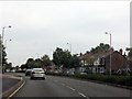
4
The Island House
A Pub on the Stafford Road.
Image: © Gordon Griffiths
Taken: 6 Feb 2008
0.16 miles
5
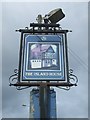
Island House - Sign
The pub closed some years ago. The pub was re-named from 'The Croft' when the A449 Stafford Road was dualled and a traffic island constructed.
Image: © John M
Taken: 29 Mar 2015
0.16 miles
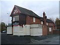
6
The former Island House PH
Boarded up awaiting its fate.
Image: © John M
Taken: 29 Mar 2015
0.16 miles
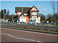
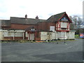
8
The Island House PH
Previously known as the Croft before the A449 was widenened to dual carriageway. The pub has been empty for several years as the refused planning permission for a KFC drive-thru and restaurant unsuccessfully went through the appeals process.
Planning permission has now been granted on the adjacent Bushbury WMC site.
Image: © John M
Taken: 16 Nov 2013
0.18 miles
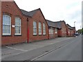
9
Oxley Primary School
The School in Ripon Road in the shadow of Goodyear's Tyre Factory has a smell of rubber hanging over it.
Image: © Gordon Griffiths
Taken: 6 Feb 2008
0.18 miles
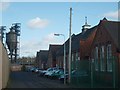
10
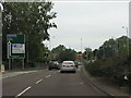
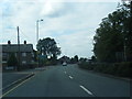
Stafford Road (A449) approaching Bushbury Lane roundabout
The style of sign visible, showing directions off the opposite carriageway by a 180 degree turn of the next roundabout, is characteristic of the Wolverhampton area.
Image: © J Whatley
Taken: 6 Sep 2010
0.19 miles