The Island House PH
Introduction
The photograph on this page of The Island House PH by John M as part of the Geograph project.
The Geograph project started in 2005 with the aim of publishing, organising and preserving representative images for every square kilometre of Great Britain, Ireland and the Isle of Man.

There are currently over 7.5m images from over 14,400 individuals and you can help contribute to the project by visiting https://www.geograph.org.uk
The Island House PH
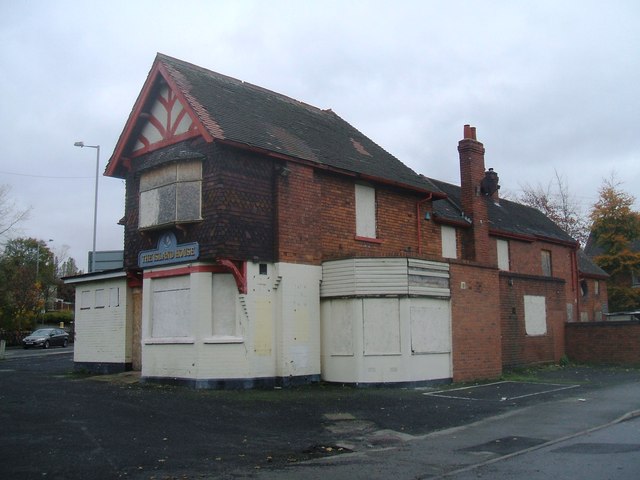
Image: © John M Taken: 16 Nov 2013
Previously known as the Croft before the A449 was widenened to dual carriageway. The pub has been empty for several years as the refused planning permission for a KFC drive-thru and restaurant unsuccessfully went through the appeals process. Planning permission has now been granted on the adjacent Bushbury WMC site.
Images are licensed for reuse under creativecommons.org/licenses/by-sa/2.0
Image Location
Latitude
52.605003
Longitude
-2.12975