
IMAGES TAKEN NEAR TO
Mortice Green, WOLVERHAMPTON, WV10 0BX
Introduction
This page details the photographs taken nearby to Mortice Green, WV10 0BX by members of the Geograph project.
The Geograph project started in 2005 with the aim of publishing, organising and preserving representative images for every square kilometre of Great Britain, Ireland and the Isle of Man.

There are currently over 7.5m images from over14,400 individuals and you can help contribute to the project by visiting https://www.geograph.org.uk
Image Map
Images are licensed for reuse under creativecommons.org/licenses/by-sa/2.0
Notes
- Clicking on the map will re-center to the selected point.
- The higher the marker number, the further away the image location is from the centre of the postcode.
Image Listing (39 Images Found)
Images are licensed for reuse under creativecommons.org/licenses/by-sa/2.0
Image
Details
Distance
1
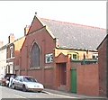
Stratton Street Methodist Church
At the North of the Grid Square in Park Village. The Church was the first building on the road and has been there since 1906.
Image: © Mike Jackson
Taken: 2 Aug 2000
0.08 miles
2
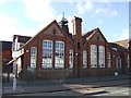
Woden Road Junior School
The school dates from 1898 and was contemporary with the surrounding Victorian terrace housing. The housing was demolished in the late 1960s and replaced with the high rise Heath Town Estate.
Image: © John M
Taken: 13 Nov 2010
0.09 miles
3

Woden Road School
The school dates from 1898 and was contemporary with the surrounding Victorian terrace housing. The housing was demolished in the late 1960s and replaced with the high rise Heath Town Estate.
Image: © John M
Taken: 13 Nov 2010
0.10 miles
4
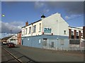
Heera Banqueting Suite (former Heath Town WMC)
The former 'Working Mens Club' is now a venue for Bhangra nights, functions and weddings.
Image: © John M
Taken: 13 Nov 2010
0.13 miles
5
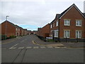
Houses on Bakewell Gardens, Springfield
Modern housing just off Springfield Road.
Image: © Richard Law
Taken: 4 Feb 2025
0.13 miles
6
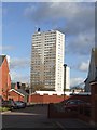
Council Housing - Heath Town Flats
The Heath Town Estate was opened by Princess Margaret in 1969.
Image: © John M
Taken: 13 Nov 2010
0.15 miles
7
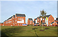
St Peter's Walk, near Springfield, Wolverhampton
Off the Wednesfield Road (A4124) this extensive new Wimpey housing development is on the former brown field site left following demolition of the Chubb Works. I wonder how this year's credit crunch is affecting sales and lettings.
The sign exclaims: Two bedroom apartments from £85,995 - Four bedroom homes from £144,995.
Image: © Roger D Kidd
Taken: 17 Dec 2008
0.15 miles
8
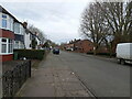
Springfield Road, Wolverhampton
Houses of the 1950s or thereabouts on Springfield Road
Image: © Richard Law
Taken: 4 Feb 2025
0.15 miles
9
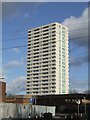
Council Housing - Heath Town Flats
The high rise estate was opened by Princess Margaret in 1969.
Image: © John M
Taken: 13 Nov 2010
0.17 miles
10
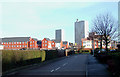
New housing towards Heath Town, Wolverhampton
The view is looking along Hemmings Close to the new housing, beyond which the high rise flats of Heath Town can be seen. This extensive housing development off the Wednesfield Road is on the former site of the Chubb Works, and part of the new century's Wolverhampton regeneration plan.
Image: © Roger D Kidd
Taken: 17 Dec 2008
0.17 miles