IMAGES TAKEN NEAR TO
Holly Lane, WALSALL, WS9 9JG
Introduction
This page details the photographs taken nearby to Holly Lane, WS9 9JG by members of the Geograph project.
The Geograph project started in 2005 with the aim of publishing, organising and preserving representative images for every square kilometre of Great Britain, Ireland and the Isle of Man.

There are currently over 7.5m images from over14,400 individuals and you can help contribute to the project by visiting https://www.geograph.org.uk
Image Map
Images are licensed for reuse under creativecommons.org/licenses/by-sa/2.0
Notes
- Clicking on the map will re-center to the selected point.
- The higher the marker number, the further away the image location is from the centre of the postcode.
Image Listing (7 Images Found)
Images are licensed for reuse under creativecommons.org/licenses/by-sa/2.0
Image
Details
Distance
2
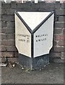
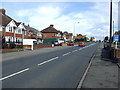
Milepost by the A461, Lichfield Road, Walsall Wood
Cast iron post by the A461, in Borough of Walsall (Walsall District), Walsall Wood, near A4152 junction, by No. 183 Lichfield Road, Shire Oak, in pavement in front of brick wall, on North West side of road. Walsall iron casting, erected by the Walsall Turnpike Trust in the 19th century.
Inscription reads:- : LICHFIELD MILES / 5½ / DERBY 29 : : WALSALL / 4 MILES :
Milestone Society National ID: ST_WLLF04.
Image: © Milestone Society
Taken: 14 Dec 2017
0.23 miles
3
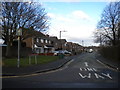
West end of Blakemore Road, Castlefort
Blakemore Road is a crescent off Castlefort Road, and is one way all the way round.
Image: © Richard Vince
Taken: 31 Jan 2015
0.24 miles
4
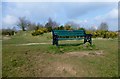
Shireoak Hill
Bagged from car park off Andrews Road.
Name: Shireoak Hill
Hill number: 17352
Height: 190m / 623ft
Parent (Ma/M): 2870 Walton Hill
Section: 39: Central and Eastern England
County/UA: Walsall (UA)
Class: Tump (100-199m)
Grid ref: SK059036 (est)
Drop: 33m
Col: 157m SK057002
Image: © Rude Health
Taken: 25 Mar 2015
0.24 miles
5
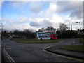
Bus turning circle, Castlefort
This turning circle is built into the junction of Link Road (left) and Castlefort Road (foreground). A Volvo B7TL/Wright Eclipse Gemini of National Express West Midlands is laying over in it, before returning to Walsall via Aldridge on route 7A.
Image: © Richard Vince
Taken: 31 Jan 2015
0.24 miles
6
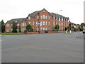
Apartments, Walsall Wood
At the crossroads of A461 Lichfield Road and B4152 Brownhills Road.
Image: © Adrian Rothery
Taken: 6 Aug 2008
0.25 miles