
IMAGES TAKEN NEAR TO
Bosty Lane, WALSALL, WS9 0QE
Introduction
This page details the photographs taken nearby to Bosty Lane, WS9 0QE by members of the Geograph project.
The Geograph project started in 2005 with the aim of publishing, organising and preserving representative images for every square kilometre of Great Britain, Ireland and the Isle of Man.

There are currently over 7.5m images from over14,400 individuals and you can help contribute to the project by visiting https://www.geograph.org.uk
Image Map
Images are licensed for reuse under creativecommons.org/licenses/by-sa/2.0
Notes
- Clicking on the map will re-center to the selected point.
- The higher the marker number, the further away the image location is from the centre of the postcode.
Image Listing (9 Images Found)
Images are licensed for reuse under creativecommons.org/licenses/by-sa/2.0
Image
Details
Distance
1
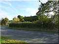
Bosty Lane Farmhouse, Aldridge
Not that you'd know it unless you checked first, but under the thick coat of ivy lies an early 18th century brick farmhouse, which was Grade II listed https://britishlistedbuildings.co.uk/101076384-bosty-lane-farmhouse-and-farm-building-adjoining-to-east-aldridge-central-and-south-ward#.XAqeZNSLTGg in 1986. Needs attention fairly soon, I'd venture to suggest.
Image: © Richard Law
Taken: 24 Oct 2018
0.07 miles
2
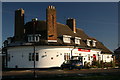
The Whitehouse pub
A fairly traditional pub which has seen a few changes over the years.
Image: © Derek Bennett
Taken: 7 Dec 2008
0.12 miles
3
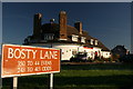
Whitehouse pub and road name
There can be no doubting the Whitehouse pub is situated on the corner of Bosty Lane in Aldridge.
Image: © Derek Bennett
Taken: 7 Dec 2008
0.12 miles
4
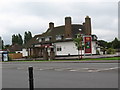
The White House
At the junction of Bosty Lane and A454 Walsall Road.
Image: © Adrian Rothery
Taken: 6 Aug 2008
0.12 miles
5
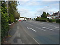
Walsall Road and Bosty Lane junction
The white articulated lorry is heading east on Bosty Lane, seen here from the A454 Walsall Road.
Image: © Richard Law
Taken: 24 Oct 2018
0.16 miles
6
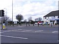
Walsall Road Junction
The junction with Bosty Lane, Rushall.
Image: © Gordon Griffiths
Taken: 28 Mar 2010
0.17 miles
7
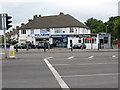
Corner Shops
General store, fish bar, Indian take-away, hair salon and sign shop.
Image: © Adrian Rothery
Taken: 6 Aug 2008
0.18 miles
8

Aldridge Airport Outdoor Activity Centre
Opened in 2006 with Big Lottery Fund support on the site of the former municipal airport.
Image: © John M
Taken: 16 Aug 2017
0.21 miles
9

The former Aldridge Airport site
A large public open area (dog walking, general sports activities etc) this is known by the Walsall Council now as the Aldridge Airport site, but it was formerly Walsall Airport or Walsall Aerodrome. It was in active use as an airport from 1938 until the early 1950s, but doesn't appear to have been a busy or permanent military/RAF base, or suitable for heavy aircraft, possibly as the site slopes somewhat and is founded on wet, clay soils, so would become waterlogged at times. One hangar has been retained as an historic feature.
Image: © Richard Law
Taken: 24 Oct 2018
0.21 miles