
IMAGES TAKEN NEAR TO
Almond Avenue, WALSALL, WS5 4JT
Introduction
This page details the photographs taken nearby to Almond Avenue, WS5 4JT by members of the Geograph project.
The Geograph project started in 2005 with the aim of publishing, organising and preserving representative images for every square kilometre of Great Britain, Ireland and the Isle of Man.

There are currently over 7.5m images from over14,400 individuals and you can help contribute to the project by visiting https://www.geograph.org.uk
Image Map
Images are licensed for reuse under creativecommons.org/licenses/by-sa/2.0
Notes
- Clicking on the map will re-center to the selected point.
- The higher the marker number, the further away the image location is from the centre of the postcode.
Image Listing (22 Images Found)
Images are licensed for reuse under creativecommons.org/licenses/by-sa/2.0
Image
Details
Distance
1
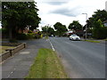
Maple Drive, The Delves
A quiet suburban street in SE Walsall.
Image: © Richard Law
Taken: 23 Jul 2015
0.07 miles
2
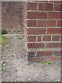
OS benchmark - The Delves, 104-94 Greenside Way
An OS cutmark on a building attached to the block of flats at 104 to 94 Greenside Way; originally levelled at 131.5m above Ordnance Datum Newlyn.
Image: © Richard Law
Taken: 23 Jul 2015
0.09 miles
3
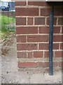
OS benchmark - The Delves, 22-32 Greenside Way
An OS cutmark on a service building outside a block of flats on the north side of Greenside Way. Originally levelled at 132.311m above Ordnance Datum Newlyn.
Image: © Richard Law
Taken: 23 Jul 2015
0.10 miles
4
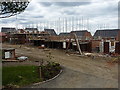
Redevelopment at the Fir Tree Primary School site
The school on this site closed in 2006, after being amalgamated with the nearby Yew Tree school on Birchfield Way slightly to the ENE of here. It is now being redeveloped into housing.
Image: © Richard Law
Taken: 23 Jul 2015
0.11 miles
5
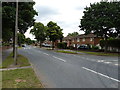
Greenside Way, The Delves
One of the main thoroughfares through this central part of The Delves, and it's needed to be treated to some traffic-calming measures to reduce vehicle speeds.
Image: © Richard Law
Taken: 23 Jul 2015
0.14 miles
8

Tiger pub
The Tiger is a traditional pub situated in the Delves area of Walsall.
Image: © Derek Bennett
Taken: 5 Apr 2009
0.18 miles
9
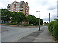
Oak Court, The Delves
An eight-storey block of flats on Acacia Avenue; there is an identical block called Yew Court just off-shot to the left.
Image: © Richard Law
Taken: 23 Jul 2015
0.18 miles
10
Sustrans Cycle Route Sculpture
One of 1000 across the UK cycle network.
Image: © Geoff Pick
Taken: 10 Oct 2009
0.19 miles