IMAGES TAKEN NEAR TO
Downham Close, WALSALL, WS5 3BX
Introduction
This page details the photographs taken nearby to Downham Close, WS5 3BX by members of the Geograph project.
The Geograph project started in 2005 with the aim of publishing, organising and preserving representative images for every square kilometre of Great Britain, Ireland and the Isle of Man.

There are currently over 7.5m images from over14,400 individuals and you can help contribute to the project by visiting https://www.geograph.org.uk
Image Map
Images are licensed for reuse under creativecommons.org/licenses/by-sa/2.0
Notes
- Clicking on the map will re-center to the selected point.
- The higher the marker number, the further away the image location is from the centre of the postcode.
Image Listing (9 Images Found)
Images are licensed for reuse under creativecommons.org/licenses/by-sa/2.0
Image
Details
Distance
1
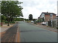
Fallowfield Road in Daisy Bank
A new house appears to be under construction to the right here, amongst pre-existing 1960s/70s houses.
Image: © Richard Law
Taken: 18 Jul 2018
0.05 miles
3
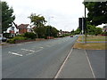
Sutton Road coming down Daisy Bank
Post-war housing lines either side of the road here.
Image: © Richard Law
Taken: 18 Jul 2018
0.10 miles
4
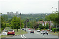
The B4151 Sutton Road approaching Walsall
A telephoto assisted image from near the former Three Crowns public house. The tower blocks on the left of the image are part of the Chuckery area of Walsall.
Image: © Roger D Kidd
Taken: 29 Jul 2011
0.12 miles
7
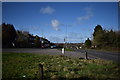
Westwards view - Walsall, West Midlands
This photo of the Skip Lane junction towards Walsall was taken from by the bus shelter on Skip Lane, on the eastern edge of the town. Skip Lane runs south-west from its junction with the B4151 Sutton Road then roughly southwards until it joins the A34 Birmingham Road to the south-east of Walsall Image This area of Walsall is served for buses by National Express West Midlands - routes 77 from Sutton Coldfield and the 934 and 935 from Birmingham run along Sutton Road. Time photo taken 10.44 am GMT (Greenwich Mean Time).
Image: © Martin Richard Phelan
Taken: 12 Feb 2020
0.24 miles
8
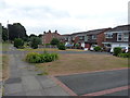
Houses on the north side of Sutton Road
Post-war houses now hem in the rather older Wood End Farm, seen here about 100 yards away on the right.
Image: © Richard Law
Taken: 18 Jul 2018
0.24 miles