IMAGES TAKEN NEAR TO
Stoney Lane, WALSALL, WS3 3RE
Introduction
This page details the photographs taken nearby to Stoney Lane, WS3 3RE by members of the Geograph project.
The Geograph project started in 2005 with the aim of publishing, organising and preserving representative images for every square kilometre of Great Britain, Ireland and the Isle of Man.

There are currently over 7.5m images from over14,400 individuals and you can help contribute to the project by visiting https://www.geograph.org.uk
Image Map
Images are licensed for reuse under creativecommons.org/licenses/by-sa/2.0
Notes
- Clicking on the map will re-center to the selected point.
- The higher the marker number, the further away the image location is from the centre of the postcode.
Image Listing (12 Images Found)
Images are licensed for reuse under creativecommons.org/licenses/by-sa/2.0
Image
Details
Distance
1
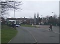
Lower Farm Estate - Little Bloxwich
This used to be a trolleybus terminus Image
Image: © John M
Taken: 8 Mar 2009
0.12 miles
2
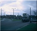
An ex-Birmingham bus at Lower Farm Estate
This photo shows a Guy Arab IV bus with Metro-Cammell 55-seater bodywork at the Lower Farm Estate terminus of route 32. This vehicle used to belong to Birmingham City Transport until it was taken over by West Midlands Passenger Transport Executive on the 1st October 1969. Route 32 was operated by trolleybuses from the 31st December 1962 until the last day of trolleybus operation on the 3rd October 1970, the date this photo was taken. The Lower Farm Estate was developed in the early 1960s with a mixture of housing ranging from maisonette blocks and multi-storey flats to semi-detached and detached houses. Sanstone Road can be seen behind the bus. National Express West Midlands now operate this service as route 302 to Walsall Bus Station via Bloxwich.
Image: © David Hillas
Taken: 3 Oct 1970
0.14 miles
3
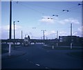
Lower Farm Estate Bus Terminus
This photo shows the Lower Farm Estate, North of Bloxwich with its trolleybus wiring and traction poles. It was taken on Saturday 3rd October 1970 which was the last day of trolleybus operation in Walsall and Bloxwich. In the background can be seen a Birmingham City Transport Guy Arab IV bus which was one of several vehicles transferred to Walsall in February 1970 to replace its second-hand trolleybuses. The overhead wiring and traction poles were taken out shortly after this photo was taken.
Image: © David Hillas
Taken: 3 Oct 1970
0.15 miles
4
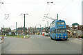
British Trolleybuses - Walsall
Lower Farm Estate terminus, Little Bloxwich. This was the last extension made to the Walsall trolleybus network and was still relatively new at the time the picture was taken. The main change today is that the two houses behind the lighting column have both been enlarged by extensions over their garages.
For a slide show of British Trolleybuses in the late 60s http://www.geograph.org.uk/search.php?i=1773236&displayclass=slide
Image: © Alan Murray-Rust
Taken: 1 Jul 1967
0.15 miles
5
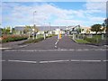
Walsall Academy
Lichfield Road, Bloxwich
Image: © Adrian Rothery
Taken: 20 Oct 2006
0.17 miles
8
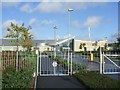
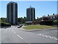
Walsall Academy
New school in Bloxwich sponsored by Thomas Telford School and the Mercers Company.
Image: © John M
Taken: 21 Oct 2006
0.21 miles