
IMAGES TAKEN NEAR TO
Field Road, WALSALL, WS3 3JE
Introduction
This page details the photographs taken nearby to Field Road, WS3 3JE by members of the Geograph project.
The Geograph project started in 2005 with the aim of publishing, organising and preserving representative images for every square kilometre of Great Britain, Ireland and the Isle of Man.

There are currently over 7.5m images from over14,400 individuals and you can help contribute to the project by visiting https://www.geograph.org.uk
Image Map
Images are licensed for reuse under creativecommons.org/licenses/by-sa/2.0
Notes
- Clicking on the map will re-center to the selected point.
- The higher the marker number, the further away the image location is from the centre of the postcode.
Image Listing (16 Images Found)
Images are licensed for reuse under creativecommons.org/licenses/by-sa/2.0
Image
Details
Distance
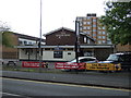
2
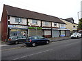
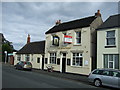
Small parade of shops on Field Road, Blakenhall Heath
Image: © Richard Law
Taken: 27 Sep 2016
0.05 miles
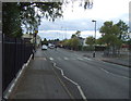
4
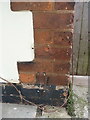
OS benchmark - Blakenall Heath, 9 Chantry Avenue
An OS cutmark on the front of the house; originally levelled, probably in 1957, at 161.181m above Ordnance Datum Newlyn.
Image: © Richard Law
Taken: 27 Sep 2016
0.07 miles
6
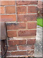
OS benchmark - Blakenall Heath, 39 Chantry Avenue
An OS cutmark on the front of the house; originally levelled, probably in 1957, at 155.259m above Ordnance Datum Newlyn.
Image: © Richard Law
Taken: 27 Sep 2016
0.15 miles
7
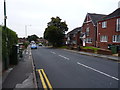
Victoria Avenue, Blakenhall Heath
Just north of Walsall, Blakenhall Heath is primarily given over to housing. Old maps prior to WW2 suggest that it was still very rural up until about the early 1930s, but building of the estates put an end to that between the wars. Many of the houses date from that period, although the ones on the right here are clearly more recent.
Image: © Richard Law
Taken: 27 Sep 2016
0.18 miles
8
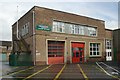
Bloxwich fire station
Bloxwich fire station, High Street, Bloxwich forms part of West Midlands Fire & Rescue Service
Image: © Kevin Hale
Taken: 29 May 2010
0.18 miles
9
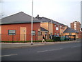
Pinfold Health Centre
New Medical Centre built in 2004, taken from the junction of Pinfold and Bloxwich Road
Image: © Edward Hunt
Taken: 14 Dec 2004
0.19 miles
10
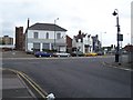
High Street, Bloxwich
The boarded-up ex TSB bank with Bloxwich fire station behind.
Image: © Adrian Rothery
Taken: 20 Oct 2006
0.19 miles