
IMAGES TAKEN NEAR TO
Evesham Crescent, WALSALL, WS3 2TN
Introduction
This page details the photographs taken nearby to Evesham Crescent, WS3 2TN by members of the Geograph project.
The Geograph project started in 2005 with the aim of publishing, organising and preserving representative images for every square kilometre of Great Britain, Ireland and the Isle of Man.

There are currently over 7.5m images from over14,400 individuals and you can help contribute to the project by visiting https://www.geograph.org.uk
Image Map
Images are licensed for reuse under creativecommons.org/licenses/by-sa/2.0
Notes
- Clicking on the map will re-center to the selected point.
- The higher the marker number, the further away the image location is from the centre of the postcode.
Image Listing (26 Images Found)
Images are licensed for reuse under creativecommons.org/licenses/by-sa/2.0
Image
Details
Distance
1
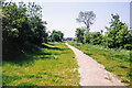
Route of Wyrley and Essington Canal from Broad Lane, 1986
The line of the Wyrley and Essington Canal heading south-west from Broad Lane, north of Bloxwich. Clearly, by 1986 this stretch of the canal had been filled in and its route was in use as a footpath. That still seems to be the case presently, (in 2021), according to aerial views.
Image: © Trevor Littlewood
Taken: 15 Jun 1986
0.02 miles
2
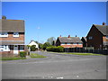
Part of Evesham Crescent, Mossley Estate
This offshoot links Evesham Crescent with the parallel Cresswell Crescent (foreground) near the former's north eastern end, opposite the Image
Image: © Richard Vince
Taken: 4 Jun 2013
0.02 miles
3
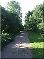
Forest of Mercia Way
Footpath along a filled in section of the Wyrley and Essington Canal near Broad Lane, Bloxwich looking towards Essington.
Image: © John M
Taken: 17 Sep 2006
0.03 miles
4
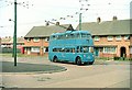
British Trolleybuses - Walsall
Mossley Estate terminus. Walsall Corporation made significant extensions of its trolleybus network into new housing estates up to the 1960s. This is the Mossley Estate terminus. At the time there was no development on the other side of the main road over the photographer's right shoulder. Looking at modern aerial photography sites, the houses appear to have changed little; there is however no sign of a telephone box.
The driver does appear to have set the wrong destination - the correct route number was 31. The trolleybus was one of several purchased second-hand from Ipswich which retained the very small destination display - virtually illegible at a reasonable distance.
For a slide show of British Trolleybuses in the late 60s http://www.geograph.org.uk/search.php?i=1773236&displayclass=slide
Image: © Alan Murray-Rust
Taken: 1 Jul 1967
0.05 miles
5
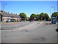
Bus turning circle, Mossley Estate
Located on Cresswell Crescent (left) just south of its junction with the north end of Tintern Crescent, this turning circle was constructed for the trolleybuses that served the Mossley from its construction until the trolleys were replaced by motorbuses in 1970. The 301, the modern day equivalent of the 31 trolleybus route, still turns here, and is one of the most frequent bus services in Walsall; I obviously arrived at a quiet moment.
Image: © Richard Vince
Taken: 4 Jun 2013
0.05 miles
6
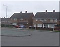
Mossley Estate
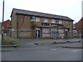
The bus terminus on Mossley Estate has been here since the era of the trolleybus Imagewith a stop outside 'The Eagle'. It is another boarded up pub looking for a buyer.
Image: © John M
Taken: 8 Mar 2009
0.05 miles
7
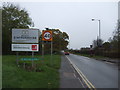
Welcome to Staffordshire
On Broad Lane (B4210).
Image: © JThomas
Taken: 9 Nov 2019
0.06 miles
8
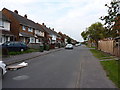
Evesham Crescent, Bloxwich
1960s semis on a housing estate north of Bloxwich.
Image: © Richard Law
Taken: 5 Sep 2013
0.06 miles
10
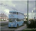
Walsall trolleybus at Mossley Estate
BUT 9611T trolleybus 874 (GFU 692) is pictured at Mossley terminus on the last day of trolleybus operation in Walsall, ie 3rd October, 1970. An ex-Birmingham motorbus is seen behind it on route 31.
Image: © David Hillas
Taken: 3 Oct 1970
0.07 miles