IMAGES TAKEN NEAR TO
Blakenall Lane, WALSALL, WS3 1HU
Introduction
This page details the photographs taken nearby to Blakenall Lane, WS3 1HU by members of the Geograph project.
The Geograph project started in 2005 with the aim of publishing, organising and preserving representative images for every square kilometre of Great Britain, Ireland and the Isle of Man.

There are currently over 7.5m images from over14,400 individuals and you can help contribute to the project by visiting https://www.geograph.org.uk
Image Map
Images are licensed for reuse under creativecommons.org/licenses/by-sa/2.0
Notes
- Clicking on the map will re-center to the selected point.
- The higher the marker number, the further away the image location is from the centre of the postcode.
Image Listing (22 Images Found)
Images are licensed for reuse under creativecommons.org/licenses/by-sa/2.0
Image
Details
Distance
1
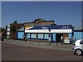
Nisa supermarket - Blakenhall
The building was originally built for the Walsall and District Cooperative Society in 1921 and is contemporary with the large council estates that were springing up around Blakenall Heath and Harden.
Image: © John M
Taken: 22 May 2010
0.02 miles
3
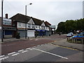
Shops and businesses on Blakenall Lane
A very similar view to the one in Image; it's a different time of year, and there are some slight changes to the businesses in the retail units over the last 6 or 7 years.
Image: © Richard Law
Taken: 27 Sep 2016
0.03 miles
4
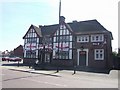
Preparing for World Cup 2010 at the New Inn - Blakenhall
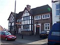
The current New Inn replaced the old New Inn in 1938. It appears to have been extended at a later date to add a lounge and what is now a pool room.
Image: © John M
Taken: 22 May 2010
0.05 miles
7
Foster Street, Blakenall Heath
A mixture of Victorian terracing and slightly more recent (inter- and post-war) housing development.
Image: © Richard Law
Taken: 27 Sep 2016
0.09 miles
9
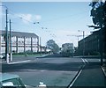
Blakenall Heath road junction (2)
This photo shows a new Daimler Fleetline bus with Northern Counties 72-seater bodywork turning from Walker Road into Blakenall Heath on route 15. This route was operated by West Midlands Passenger Transport Executive and was operated by trolleybuses until Saturday 3rd October, 1970 the date this photo was taken. The trolleybus overhead wiring and traction poles were dismantled within a few months of that date. Route 29 operated by National Express West Midlands now operates along the same roads as did former route 15 between Walsall and Bloxwich. The housing on the left of the photo and the building on the right have since been demolished.
Image: © David Hillas
Taken: 3 Oct 1970
0.11 miles