
IMAGES TAKEN NEAR TO
Harden Road, WALSALL, WS3 1BY
Introduction
This page details the photographs taken nearby to Harden Road, WS3 1BY by members of the Geograph project.
The Geograph project started in 2005 with the aim of publishing, organising and preserving representative images for every square kilometre of Great Britain, Ireland and the Isle of Man.

There are currently over 7.5m images from over14,400 individuals and you can help contribute to the project by visiting https://www.geograph.org.uk
Image Map
Images are licensed for reuse under creativecommons.org/licenses/by-sa/2.0
Notes
- Clicking on the map will re-center to the selected point.
- The higher the marker number, the further away the image location is from the centre of the postcode.
Image Listing (12 Images Found)
Images are licensed for reuse under creativecommons.org/licenses/by-sa/2.0
Image
Details
Distance
1

OS benchmark - Harden, shops at roundabout
An OS cutmark on the jutting brickwork of one of the shops in the background of Image, which was originally levelled in 1957 at 162.949m above Ordnance Datum Newlyn.
Image: © Richard Law
Taken: 14 Mar 2019
0.03 miles
2
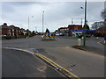
Roundabout on Harden Road
At the junction with Chestnut Road (to the right) and Walker Road (off to the left).
Image: © Richard Law
Taken: 14 Mar 2019
0.05 miles
3

OS benchmark - Harden, 154 Harden Road
An OS cutmark on the wall by the front door of 154 Harden Road; originally levelled in 1957 at 163.882m above Ordnance Datum Newlyn.
Image: © Richard Law
Taken: 14 Mar 2019
0.08 miles
4

Shakespeare Crescent
Taken from the safety of the canal's far bank.
Image: © Adrian Rothery
Taken: 20 Oct 2006
0.17 miles
5
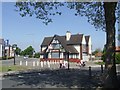
Royal Oak - Walker Road
The pub dates from 1929 and replaced an earlier Royal Oak nearby in Harden Lane. The pub was contemporary with the large 1920s council estates that were developed in Blakenall and Harden. It is currently on the market at £205000.
Image: © John M
Taken: 22 May 2010
0.19 miles
6
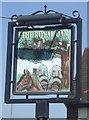
Royal Oak sign
Based on the incident at Boscobel during the escape of King Charles II after the Battle of Worcester. Image]
Image: © John M
Taken: 22 May 2010
0.20 miles
7
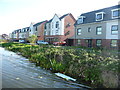
Canalside homes on Razorbill Way, Harden
Replacing a long street of houses called Shakespeare Crescent.
Image: © Christine Johnstone
Taken: 6 May 2018
0.20 miles
8

Canalside homes on Oystercatcher Grove, Harden
Replacing homes in Shakespeare Crescent.
Image: © Christine Johnstone
Taken: 6 May 2018
0.20 miles
9
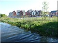
New housing development off Turnstone Road, Harden
On the west bank of the Wyrley & Essington Canal.
Image: © Christine Johnstone
Taken: 6 May 2018
0.21 miles
10

Signposted footpath to Goscote Lane
Dropping down from the Wyrley & Essington Canal towpath. Not mapped as a public footpath.
Image: © Christine Johnstone
Taken: 6 May 2018
0.23 miles